Earthquake KEP. MENTAWAI REGION, INDONESIA
Mon, 25 Feb 2008 13:33:52 GMT
Time17 years ago
Location
-2.2500, 99.9100
Depth
41.0 KM
Event Summary
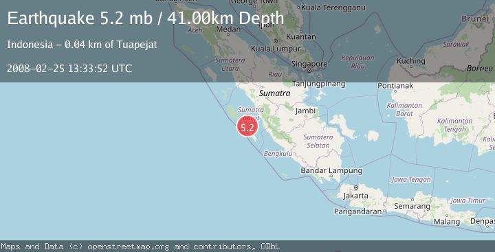
A 5.2 magnitude earthquake struck on KEP. MENTAWAI REGION, INDONESIA, at Mon, 25 Feb 2008 13:33:52 GMT. Depth: 41km. Reviewed by EMSC seismologists, this moderate quake occurred at a magnitude type of mb.
Magnitude
5.2
mb
Source
EMSC
Intensity
-
Agency Reports
1 Sources| Source | Magnitude | Depth | Time |
|---|---|---|---|
| EMSCPrimary | 5.2 | 41 km | 17 years ago |
Earthquake Details
AutomaticEvent IDemsc_EMSC_20080225_0000063
Tsunami PotentialNo
Magnitude Typemb
Nearest Places
- Sipagugu12.3 km
- Pulau Pusaoat13.1 km
- Pulau Puserepangan13.6 km
- Teluk Simabai14.0 km
- Sungai Sigici14.2 km
Comments
Join the discussion about this event.
Latest Earthquakes
2.2Mag
Seram, Indonesia
Time2 minutes ago
Depth11.12 km
SourceBMKG
2.6Mag
West Papua Region, Indonesia
Time4 minutes ago
Depth17.35 km
SourceBMKG
2.8Mag
Antofagasta, Chile
Time8 minutes ago
Depth0.00 km
SourceVYT (Automatic)
3.3Mag
Near North Coast of West Papua
Time9 minutes ago
Depth10.00 km
SourceBMKG
2.5Mag
off the coast of Tarapaca, Chile
Time10 minutes ago
Depth0.00 km
SourceVYT (Automatic)
Nearby Earthquakes
5.2Mag
KEP. MENTAWAI REGION, INDONESIA
Time8 years ago
Depth40.00 km
SourceEMSC (Automatic)
6.5Mag
KEP. MENTAWAI REGION, INDONESIA
Time17 years ago
Depth40.00 km
SourceEMSC (Automatic)
5.7Mag
KEP. MENTAWAI REGION, INDONESIA
Time18 years ago
Depth34.00 km
SourceEMSC (Automatic)
6.3Mag
KEP. MENTAWAI REGION, INDONESIA
Time17 years ago
Depth30.00 km
SourceEMSC (Automatic)
5.5Mag
KEP. MENTAWAI REGION, INDONESIA
Time17 years ago
Depth34.00 km
SourceEMSC (Automatic)