Earthquake BANDA SEA
Fri, 28 Mar 2008 15:53:37 GMT
Time17 years ago
Location
-4.5400, 128.5700
Depth
263.0 KM
Event Summary
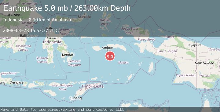
A 5.0 magnitude earthquake struck on BANDA SEA, at Fri, 28 Mar 2008 15:53:37 GMT. Depth: 263km. Reviewed by EMSC seismologists, this moderate quake occurred at a magnitude type of mb.
Magnitude
5.0
mb
Source
EMSC
Intensity
-
Agency Reports
1 Sources| Source | Magnitude | Depth | Time |
|---|---|---|---|
| EMSCPrimary | 5.0 | 263 km | 17 years ago |
Earthquake Details
AutomaticEvent IDemsc_EMSC_20080328_0000054
Tsunami PotentialNo
Magnitude Typemb
Nearest Places
- Tanjung Haur95.9 km
- Tanjung Kilang95.9 km
- Teluk Hahila96.0 km
- Tanjung Lasak96.2 km
- Teluk Hukurila96.2 km
Comments
Join the discussion about this event.
Latest Earthquakes
2.0Mag
CENTRAL CALIFORNIA
Time2 hours ago
Depth3.10 km
SourceNC (Automatic)
3.5Mag
GREENLAND SEA
Time2 hours ago
Depth8.50 km
SourceNORSAR (Automatic)
3.6Mag
New Ireland region, Papua New Guinea
Time3 hours ago
Depth233.52 km
SourceVYT (Automatic)
2.8Mag
Sumba Region, Indonesia
Time3 hours ago
Depth8.80 km
SourceBMKG
2.1Mag
Tarapaca, Chile
Time3 hours ago
Depth115.11 km
SourceVYT (Automatic)
Nearby Earthquakes
4.0Mag
BANDA SEA
Time7 years ago
Depth205.00 km
SourceNEIC (Automatic)
4.3Mag
BANDA SEA
Time1 month ago
Depth550.70 km
SourceNEIC (Automatic)
2.8Mag
BANDA SEA
Time1 month ago
Depth10.00 km
SourceBMKG (Automatic)
3.0Mag
BANDA SEA
Time2 years ago
Depth106.00 km
SourceBMKG (Automatic)
3.7Mag
Banda Sea
Time5 days ago
Depth422.00 km
SourceVYT (Automatic)