Earthquake EAST TIMOR REGION
Sat, 24 Jan 2009 13:52:26 GMT
Time17 years ago
Location
-8.4300, 125.1000
Depth
10.0 KM
Event Summary
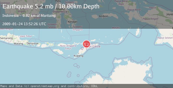
A 5.2 magnitude earthquake struck on EAST TIMOR REGION, at Sat, 24 Jan 2009 13:52:26 GMT. Depth: 10km. Reviewed by EMSC seismologists, this moderate quake occurred at a magnitude type of mb.
Magnitude
5.2
mb
Source
EMSC
Intensity
-
Agency Reports
1 Sources| Source | Magnitude | Depth | Time |
|---|---|---|---|
| EMSCPrimary | 5.2 | 10 km | 17 years ago |
Earthquake Details
AutomaticEvent IDemsc_EMSC_20090124_0000072
Tsunami PotentialNo
Magnitude Typemb
Nearest Places
- Ombai Strait7.4 km
- Tanjung Sawarana9.2 km
- Tanjung Kilasa9.3 km
- Teluk Moloko9.3 km
- Alu Karangleilu9.5 km
Comments
Join the discussion about this event.
Latest Earthquakes
1.1Mag
31 km WSW of Ackerly, Texas
Time12 hours ago
Depth3.93 km
SourceUSGS (Automatic)
2.4Mag
West Papua Region, Indonesia
Time12 hours ago
Depth10.00 km
SourceBMKG
3.3Mag
Talaud Islands, Indonesia
Time12 hours ago
Depth10.00 km
SourceBMKG
1.1Mag
4 km NW of The Geysers, CA
Time12 hours ago
Depth3.39 km
SourceUSGS (Automatic)
1.0Mag
33 km WSW of Ackerly, Texas
Time12 hours ago
Depth4.44 km
SourceUSGS (Automatic)
Nearby Earthquakes
3.0Mag
Timor Region
Time2 weeks ago
Depth31.54 km
SourceBMKG (Automatic)
5.5Mag
EAST TIMOR REGION
Time10 years ago
Depth40.00 km
SourceEMSC (Automatic)
3.0Mag
EAST TIMOR REGION
Time6 months ago
Depth71.00 km
SourceBMKG (Automatic)
3.0Mag
KEPULAUAN ALOR, INDONESIA
Time2 months ago
Depth10.00 km
SourceBMKG (Automatic)
2.5Mag
Timor Region
Time2 weeks ago
Depth21.54 km
SourceBMKG (Automatic)