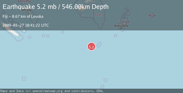
Earthquake SOUTH OF FIJI ISLANDS
Fri, 27 Mar 2009 10:41:22 GMT
Time16 years ago
Location
-24.0700, 179.6700
Depth
546.0 KM
Event Summary
A 5.2 magnitude earthquake struck on SOUTH OF FIJI ISLANDS, at Fri, 27 Mar 2009 10:41:22 GMT. Depth: 546km. Reviewed by EMSC seismologists, this moderate quake occurred at a magnitude type of mb.
Magnitude
5.2
mb
Source
EMSC
Intensity
-
Agency Reports
1 Sources| Source | Magnitude | Depth | Time |
|---|---|---|---|
| EMSCPrimary | 5.2 | 546 km | 16 years ago |
Earthquake Details
AutomaticEvent IDemsc_EMSC_20090327_0000054
Tsunami PotentialNo
Magnitude Typemb
Nearest Places
- South Minerva Reef124.4 km
- Herald Bight124.4 km
- Minerva Reefs137.7 km
- North Minerva Reef150.1 km
- Naicibaciba Rock370.0 km
Comments
Join the discussion about this event.
Latest Earthquakes
1.7Mag
Alaska Peninsula
Time1 minute ago
Depth0.00 km
SourceVYT (Automatic)
1.4Mag
Kenai Peninsula, Alaska
Time4 minutes ago
Depth1.95 km
SourceVYT (Automatic)
3.1Mag
Northern Sumatra, Indonesia
Time5 minutes ago
Depth14.69 km
SourceBMKG
1.9Mag
Channel Islands region, California
Time5 minutes ago
Depth2.81 km
SourceVYT (Automatic)
3.3Mag
Southern Alaska
Time12 minutes ago
Depth13.06 km
SourceVYT (Automatic)
Nearby Earthquakes
6.1Mag
SOUTH OF FIJI ISLANDS
Time8 years ago
Depth524.00 km
SourceEMSC (Automatic)
5.1Mag
SOUTH OF FIJI ISLANDS
Time1 year ago
Depth521.40 km
SourceEMSC (Automatic)
5.5Mag
SOUTH OF FIJI ISLANDS
Time7 years ago
Depth536.00 km
SourceEMSC (Automatic)
5.6Mag
SOUTH OF FIJI ISLANDS
Time5 years ago
Depth531.00 km
SourceEMSC (Automatic)
5.0Mag
SOUTH OF FIJI ISLANDS
Time10 years ago
Depth504.00 km
SourceEMSC (Automatic)