Earthquake HALMAHERA, INDONESIA
Tue, 18 Aug 2009 01:31:12 GMT
Time16 years ago
Location
1.8600, 127.3700
Depth
110.0 KM
Event Summary
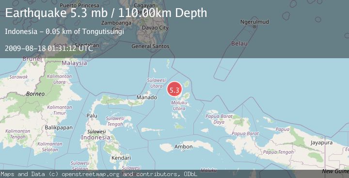
A 5.3 magnitude earthquake struck on HALMAHERA, INDONESIA, at Tue, 18 Aug 2009 01:31:12 GMT. Depth: 110km. Reviewed by EMSC seismologists, this moderate quake occurred at a magnitude type of mb.
Magnitude
5.3
mb
Source
EMSC
Intensity
-
Agency Reports
1 Sources| Source | Magnitude | Depth | Time |
|---|---|---|---|
| EMSCPrimary | 5.3 | 110 km | 16 years ago |
Earthquake Details
AutomaticEvent IDemsc_EMSC_20090818_0000055
Tsunami PotentialNo
Magnitude Typemb
Nearest Places
- Pulau Tutu22.7 km
- Tanjung Tutumadehe23.0 km
- Tanjung Tobadiku-mhe23.5 km
- Pulau Moreporoco23.9 km
- Pulau Tongidi24.1 km
Comments
Join the discussion about this event.
Latest Earthquakes
2.7Mag
Near North Coast of West Papua
Time10 minutes ago
Depth45.06 km
SourceBMKG
1.2Mag
Central Alaska
Time11 minutes ago
Depth0.85 km
SourceVYT (Automatic)
2.6Mag
West Papua Region, Indonesia
Time13 minutes ago
Depth10.00 km
SourceBMKG
2.3Mag
WESTERN TURKEY
Time16 minutes ago
Depth10.10 km
SourceKOERI (Automatic)
2.6Mag
Antofagasta, Chile
Time18 minutes ago
Depth0.00 km
SourceVYT (Automatic)
Nearby Earthquakes
5.3Mag
HALMAHERA, INDONESIA
Time17 years ago
Depth100.00 km
SourceEMSC (Automatic)
4.9Mag
HALMAHERA, INDONESIA
Time1 month ago
Depth109.00 km
SourceEMSC (Automatic)
5.5Mag
HALMAHERA, INDONESIA
Time21 years ago
Depth33.00 km
SourceEMSC (Automatic)
3.0Mag
HALMAHERA, INDONESIA
Time1 year ago
Depth105.00 km
SourceBMKG (Automatic)
3.0Mag
HALMAHERA, INDONESIA
Time1 month ago
Depth121.00 km
SourceBMKG (Automatic)