Earthquake SOUTH OF KERMADEC ISLANDS
Wed, 09 Sep 2009 10:33:05 GMT
Time16 years ago
Location
-32.2900, -179.9100
Depth
339.0 KM
Event Summary
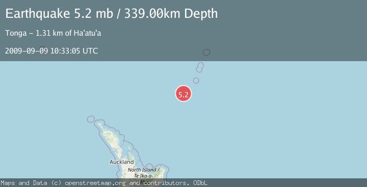
A 5.2 magnitude earthquake struck on SOUTH OF KERMADEC ISLANDS, at Wed, 09 Sep 2009 10:33:05 GMT. Depth: 339km. Reviewed by EMSC seismologists, this moderate quake occurred at a magnitude type of mb.
Magnitude
5.2
mb
Source
EMSC
Intensity
-
Agency Reports
1 Sources| Source | Magnitude | Depth | Time |
|---|---|---|---|
| EMSCPrimary | 5.2 | 339 km | 16 years ago |
Earthquake Details
AutomaticEvent IDemsc_EMSC_20090909_0000097
Tsunami PotentialNo
Magnitude Typemb
Nearest Places
- Oliver Knoll25.2 km
- Speight Knoll32.0 km
- Haungaroa Seamount44.9 km
- Star of Bengal Bank77.4 km
- Havre Trough96.0 km
Comments
Join the discussion about this event.
Latest Earthquakes
2.7Mag
Kenai Peninsula, Alaska
Time4 minutes ago
Depth37.60 km
SourceVYT (Automatic)
1.1Mag
Washington
Time5 minutes ago
Depth0.00 km
SourceVYT (Automatic)
3.2Mag
Region Metropolitana, Chile
Time6 minutes ago
Depth99.73 km
SourceVYT (Automatic)
2.4Mag
Sumba Region, Indonesia
Time10 minutes ago
Depth17.38 km
SourceBMKG
2.1Mag
West Papua Region, Indonesia
Time12 minutes ago
Depth10.00 km
SourceBMKG
Nearby Earthquakes
5.1Mag
SOUTH OF KERMADEC ISLANDS
Time17 years ago
Depth236.00 km
SourceEMSC (Automatic)
5.3Mag
SOUTH OF KERMADEC ISLANDS
Time12 years ago
Depth218.00 km
SourceEMSC (Automatic)
4.0Mag
SOUTH OF KERMADEC ISLANDS
Time3 years ago
Depth300.00 km
SourceGNS (Automatic)
4.0Mag
SOUTH OF KERMADEC ISLANDS
Time3 years ago
Depth375.00 km
SourceEMSC (Automatic)
5.7Mag
SOUTH OF KERMADEC ISLANDS
Time7 years ago
Depth238.00 km
SourceNEIC (Automatic)