Earthquake SOUTH OF KERMADEC ISLANDS
Thu, 26 Nov 2009 18:33:12 GMT
Time16 years ago
Location
-34.4600, -178.4700
Depth
2.0 KM
Event Summary
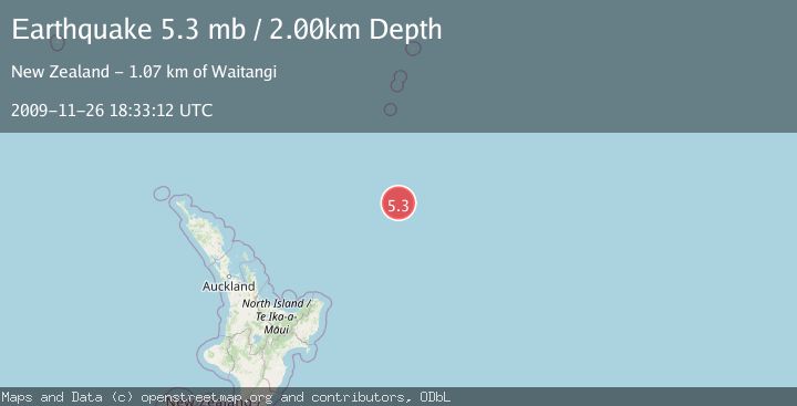
A 5.3 magnitude earthquake struck on SOUTH OF KERMADEC ISLANDS, at Thu, 26 Nov 2009 18:33:12 GMT. Depth: 2km. Reviewed by EMSC seismologists, this moderate quake occurred at a magnitude type of mb.
Magnitude
5.3
mb
Source
EMSC
Intensity
-
Agency Reports
1 Sources| Source | Magnitude | Depth | Time |
|---|---|---|---|
| EMSCPrimary | 5.3 | 2 km | 16 years ago |
Earthquake Details
AutomaticEvent IDemsc_EMSC_20091126_0000035
Tsunami PotentialNo
Magnitude Typemb
Nearest Places
- Ngātoroirangi Seamount178.8 km
- Kuiwai Seamount196.8 km
- Kibblewhite Seamount207.8 km
- Brothers Seamount230.5 km
- Haungaroa Seamount231.3 km
Comments
Join the discussion about this event.
Latest Earthquakes
0.7Mag
7 km WNW of Cobb, CA
Time4 minutes ago
Depth1.75 km
SourceUSGS (Automatic)
1.2Mag
9 km N of Banning, CA
Time6 minutes ago
Depth18.03 km
SourceUSGS (Automatic)
2.1Mag
Southern California
Time7 minutes ago
Depth8.54 km
SourceVYT (Automatic)
2.2Mag
Sweden
Time11 minutes ago
Depth0.00 km
SourceVYT (Automatic)
2.6Mag
West Papua Region, Indonesia
Time14 minutes ago
Depth14.47 km
SourceBMKG
Nearby Earthquakes
5.2Mag
SOUTH OF KERMADEC ISLANDS
Time1 year ago
Depth10.00 km
SourceEMSC (Automatic)
5.5Mag
SOUTH OF KERMADEC ISLANDS
Time9 years ago
Depth10.00 km
SourceEMSC (Automatic)
6.2Mag
SOUTH OF KERMADEC ISLANDS
Time7 years ago
Depth10.00 km
SourceEMSC (Automatic)
5.6Mag
SOUTH OF KERMADEC ISLANDS
Time18 years ago
Depth10.00 km
SourceEMSC (Automatic)
5.0Mag
SOUTH OF KERMADEC ISLANDS
Time18 years ago
Depth10.00 km
SourceEMSC (Automatic)