Earthquake SOUTH OF KERMADEC ISLANDS
Fri, 18 May 2018 01:45:31 GMT
Time7 years ago
Location
-34.6600, -178.3800
Depth
10.0 KM
Event Summary
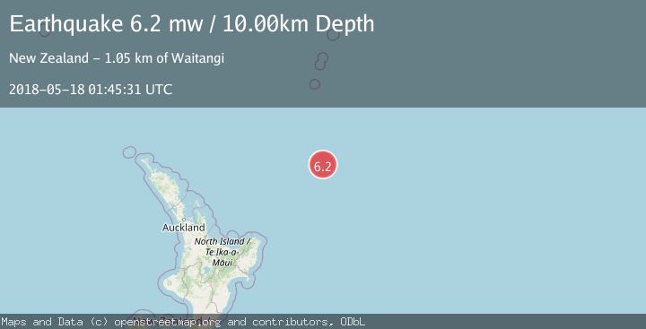
A 6.2 magnitude earthquake struck on SOUTH OF KERMADEC ISLANDS, at Fri, 18 May 2018 01:45:31 GMT. Depth: 10km. Reviewed by EMSC seismologists, this strong quake occurred at a magnitude type of mw.
Magnitude
6.2
mw
Source
EMSC
Intensity
-
Agency Reports
1 Sources| Source | Magnitude | Depth | Time |
|---|---|---|---|
| EMSCPrimary | 6.2 | 10 km | 7 years ago |
Earthquake Details
AutomaticEvent IDemsc_EMSC_20180518_0000013
Tsunami PotentialNo
Magnitude Typemw
Nearest Places
- Ngātoroirangi Seamount196.7 km
- Hinemoa Seamount215.1 km
- Kibblewhite Seamount215.3 km
- Kuiwai Seamount218.8 km
- Brothers Seamount235.0 km
Comments
Join the discussion about this event.
Latest Earthquakes
1.9Mag
northern Alaska
Time3 minutes ago
Depth10.00 km
SourceVYT (Automatic)
0.9Mag
Washington
Time3 minutes ago
Depth0.00 km
SourceVYT (Automatic)
3.1Mag
Savu Sea
Time7 minutes ago
Depth119.50 km
SourceBMKG
1.2Mag
Southeastern Alaska
Time11 minutes ago
Depth0.00 km
SourceVYT (Automatic)
3.4Mag
Talaud Islands, Indonesia
Time11 minutes ago
Depth15.68 km
SourceBMKG
Nearby Earthquakes
5.2Mag
SOUTH OF KERMADEC ISLANDS
Time1 year ago
Depth10.00 km
SourceEMSC (Automatic)
5.3Mag
SOUTH OF KERMADEC ISLANDS
Time16 years ago
Depth2.00 km
SourceEMSC (Automatic)
5.5Mag
SOUTH OF KERMADEC ISLANDS
Time9 years ago
Depth10.00 km
SourceEMSC (Automatic)
5.4Mag
SOUTH OF KERMADEC ISLANDS
Time17 years ago
Depth40.00 km
SourceEMSC (Automatic)
5.6Mag
SOUTH OF KERMADEC ISLANDS
Time18 years ago
Depth10.00 km
SourceEMSC (Automatic)