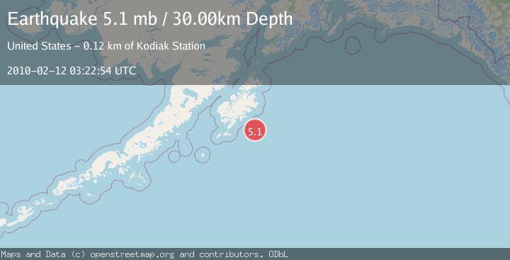
Earthquake KODIAK ISLAND REGION, ALASKA
Fri, 12 Feb 2010 03:22:54 GMT
Time16 years ago
Location
56.6900, -152.3800
Depth
30.0 KM
Event Summary
A 5.1 magnitude earthquake struck on KODIAK ISLAND REGION, ALASKA, at Fri, 12 Feb 2010 03:22:54 GMT. Depth: 30km. Reviewed by EMSC seismologists, this moderate quake occurred at a magnitude type of mb.
Magnitude
5.1
mb
Source
EMSC
Intensity
-
Agency Reports
1 Sources| Source | Magnitude | Depth | Time |
|---|---|---|---|
| EMSCPrimary | 5.1 | 30 km | 16 years ago |
Earthquake Details
AutomaticEvent IDemsc_EMSC_20100212_0000005
Tsunami PotentialNo
Magnitude Typemb
Nearest Places
- Albatross Bank17.6 km
- Albatross Bank22.4 km
- Albatross Bank58.3 km
- Onihitsk (historical)59.1 km
- Cape Barnabas59.3 km
Comments
Join the discussion about this event.
Latest Earthquakes
1.0Mag
Southeastern Alaska
Time1 minute ago
Depth0.00 km
SourceVYT (Automatic)
3.5Mag
COOK STRAIT, NEW ZEALAND
Time2 minutes ago
Depth75.30 km
SourceGNS (Automatic)
2.4Mag
Seram, Indonesia
Time4 minutes ago
Depth18.42 km
SourceBMKG
2.6Mag
West Papua Region, Indonesia
Time6 minutes ago
Depth17.35 km
SourceBMKG
2.8Mag
Antofagasta, Chile
Time10 minutes ago
Depth0.00 km
SourceVYT (Automatic)
Nearby Earthquakes
5.1Mag
KODIAK ISLAND REGION, ALASKA
Time6 years ago
Depth10.00 km
SourceEMSC (Automatic)
5.1Mag
KODIAK ISLAND REGION, ALASKA
Time16 years ago
Depth10.00 km
SourceEMSC (Automatic)
5.6Mag
KODIAK ISLAND REGION, ALASKA
Time5 months ago
Depth10.00 km
SourceEMSC (Automatic)
3.0Mag
KODIAK ISLAND REGION, ALASKA
Time6 years ago
Depth2.00 km
SourceNEIC (Automatic)
3.0Mag
KODIAK ISLAND REGION, ALASKA
Time1 year ago
Depth10.00 km
SourceNEIC (Automatic)