Earthquake SAVU SEA
Mon, 27 Jun 2011 16:47:15 GMT
Time14 years ago
Location
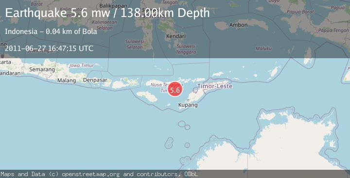
-9.1100, 122.4500
Depth
138.0 KM
Event Summary
A 5.6 magnitude earthquake struck on SAVU SEA, at Mon, 27 Jun 2011 16:47:15 GMT. Depth: 138km. Reviewed by EMSC seismologists, this moderate quake occurred at a magnitude type of mw.
Magnitude
5.6
mw
Source
EMSC
Intensity
-
Agency Reports
1 Sources| Source | Magnitude | Depth | Time |
|---|---|---|---|
| EMSCPrimary | 5.6 | 138 km | 14 years ago |
Earthquake Details
AutomaticEvent IDemsc_EMSC_20110627_0000044
Tsunami PotentialNo
Magnitude Typemw
Nearest Places
- Tanjung Teping40.6 km
- Tanjung Magemoat40.8 km
- Napung Urut41.0 km
- Wair Hawa41.0 km
- Habibola41.1 km
Comments
Join the discussion about this event.
Latest Earthquakes
4.5Mag
Central Alaska
Time1 minute ago
Depth7.81 km
SourceVYT (Automatic)
1.9Mag
1 km SSW of Pāhala, Hawaii
Time5 minutes ago
Depth28.47 km
SourceUSGS (Automatic)
1.5Mag
5 km NW of The Geysers, CA
Time6 minutes ago
Depth2.47 km
SourceUSGS (Automatic)
0.3Mag
10 km WNW of The Geysers, CA
Time8 minutes ago
Depth2.50 km
SourceUSGS (Automatic)
2.5Mag
Central Alaska
Time10 minutes ago
Depth112.55 km
SourceVYT (Automatic)
Nearby Earthquakes
3.6Mag
Savu Sea
Time2 weeks ago
Depth53.53 km
SourceBMKG (Automatic)
5.2Mag
SAVU SEA
Time8 years ago
Depth137.00 km
SourceEMSC (Automatic)
4.9Mag
SAVU SEA
Time1 month ago
Depth90.00 km
SourceEMSC (Automatic)
2.0Mag
Flores Region, Indonesia
Time1 week ago
Depth21.31 km
SourceBMKG (Automatic)
3.0Mag
SAVU SEA
Time10 months ago
Depth30.00 km
SourceBMKG (Automatic)