Earthquake Savu Sea
Sun, 01 Feb 2026 09:09:21 GMT
Time1 day ago
Location
-9.1530, 122.4778
Depth
53.5 KM
Event Summary
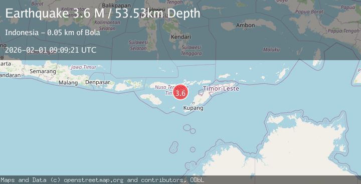
A 3.6 magnitude earthquake struck on Savu Sea, at Sun, 01 Feb 2026 09:09:21 GMT. Depth: 53.526993km. Reviewed by BMKG seismologists, this minor quake occurred at a magnitude type of M.
Magnitude
3.6
M
Source
BMKG
Intensity
-
Agency Reports
1 Sources| Source | Magnitude | Depth | Time |
|---|---|---|---|
| BMKGPrimary | 3.6 | 54 km | 1 day ago |
Earthquake Details
AutomaticEvent IDbmg2026cfis
Tsunami PotentialNo
Magnitude TypeM
Nearest Places
- Tanjung Magemoat45.9 km
- Tanjung Teping45.9 km
- Napung Urut46.1 km
- Napung Leu46.3 km
- Napung Dagar46.4 km
Comments
Join the discussion about this event.
Latest Earthquakes
0.7Mag
5 km NNW of The Geysers, CA
Time5 hours ago
Depth1.68 km
SourceUSGS (Automatic)
2.6Mag
Flores Region, Indonesia
Time5 hours ago
Depth8.34 km
SourceBMKG (Automatic)
2.5Mag
Northern Sumatra, Indonesia
Time5 hours ago
Depth198.72 km
SourceBMKG (Automatic)
3.0Mag
COOK STRAIT, NEW ZEALAND
Time5 hours ago
Depth99.80 km
SourceGNS (Automatic)
2.2Mag
Java, Indonesia
Time5 hours ago
Depth114.14 km
SourceBMKG (Automatic)
Nearby Earthquakes
3.0Mag
Flores Region, Indonesia
Time1 week ago
Depth84.08 km
SourceBMKG (Automatic)
3.0Mag
Timor Region
Time18 hours ago
Depth12.90 km
SourceBMKG (Automatic)
2.4Mag
Flores Region, Indonesia
Time1 week ago
Depth21.00 km
SourceBMKG (Automatic)
2.8Mag
Flores Region, Indonesia
Time2 days ago
Depth127.63 km
SourceBMKG (Automatic)
2.1Mag
Savu Sea
Time1 day ago
Depth25.41 km
SourceBMKG (Automatic)