Earthquake KEPULAUAN KAI, INDONESIA
Sun, 07 Aug 2011 23:05:11 GMT
Time14 years ago
Location
-5.3900, 133.9400
Depth
10.0 KM
Event Summary
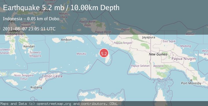
A 5.2 magnitude earthquake struck on KEPULAUAN KAI, INDONESIA, at Sun, 07 Aug 2011 23:05:11 GMT. Depth: 10km. Reviewed by EMSC seismologists, this moderate quake occurred at a magnitude type of mb.
Magnitude
5.2
mb
Source
EMSC
Intensity
-
Agency Reports
1 Sources| Source | Magnitude | Depth | Time |
|---|---|---|---|
| EMSCPrimary | 5.2 | 10 km | 14 years ago |
Earthquake Details
AutomaticEvent IDemsc_EMSC_20110807_0000066
Tsunami PotentialNo
Magnitude Typemb
Nearest Places
- Java Reef35.3 km
- Pulau Wasir38.8 km
- Wasir40.2 km
- Selat Wasir42.1 km
- Tanjung Tutupano42.4 km
Comments
Join the discussion about this event.
Latest Earthquakes
2.2Mag
Seram, Indonesia
Time3 minutes ago
Depth11.12 km
SourceBMKG
2.6Mag
West Papua Region, Indonesia
Time5 minutes ago
Depth17.35 km
SourceBMKG
2.8Mag
Antofagasta, Chile
Time9 minutes ago
Depth0.00 km
SourceVYT (Automatic)
3.3Mag
Near North Coast of West Papua
Time10 minutes ago
Depth10.00 km
SourceBMKG
2.5Mag
off the coast of Tarapaca, Chile
Time11 minutes ago
Depth0.00 km
SourceVYT (Automatic)
Nearby Earthquakes
6.0Mag
KEPULAUAN KAI, INDONESIA
Time15 years ago
Depth10.00 km
SourceEMSC (Automatic)
5.1Mag
KEPULAUAN KAI, INDONESIA
Time3 months ago
Depth6.50 km
SourceEMSC (Automatic)
4.0Mag
KEPULAUAN KAI, INDONESIA
Time2 years ago
Depth10.00 km
SourceNEIC (Automatic)
5.0Mag
KEPULAUAN KAI, INDONESIA
Time6 years ago
Depth10.00 km
SourceEMSC (Automatic)
3.0Mag
KEPULAUAN KAI, INDONESIA
Time5 years ago
Depth10.00 km
SourceDJA (Automatic)