Earthquake KERMADEC ISLANDS REGION
Mon, 24 Oct 2011 17:34:55 GMT
Time14 years ago
Location
-31.9300, -178.9300
Depth
72.0 KM
Event Summary
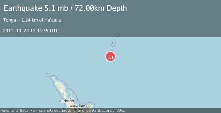
A 5.1 magnitude earthquake struck on KERMADEC ISLANDS REGION, at Mon, 24 Oct 2011 17:34:55 GMT. Depth: 72km. Reviewed by EMSC seismologists, this moderate quake occurred at a magnitude type of mb.
Magnitude
5.1
mb
Source
EMSC
Intensity
-
Agency Reports
1 Sources| Source | Magnitude | Depth | Time |
|---|---|---|---|
| EMSCPrimary | 5.1 | 72 km | 14 years ago |
Earthquake Details
AutomaticEvent IDemsc_EMSC_20111024_0000124
Tsunami PotentialNo
Magnitude Typemb
Nearest Places
- L'Esperance Rock55.3 km
- Star of Bengal Bank56.4 km
- Havre Rock64.8 km
- Havre Trough72.1 km
- Speight Knoll80.2 km
Comments
Join the discussion about this event.
Latest Earthquakes
4.2Mag
Kepulauan Talaud, Indonesia
Time6 minutes ago
Depth85.57 km
SourceVYT (Automatic)
2.0Mag
Antofagasta, Chile
Time8 minutes ago
Depth127.32 km
SourceVYT (Automatic)
2.0Mag
Southern California
Time17 minutes ago
Depth14.40 km
SourceVYT (Automatic)
3.0Mag
Potosi, Bolivia
Time19 minutes ago
Depth188.11 km
SourceVYT (Automatic)
1.3Mag
9 km WNW of The Geysers, CA
Time20 minutes ago
Depth2.36 km
SourceUSGS (Automatic)
Nearby Earthquakes
5.0Mag
KERMADEC ISLANDS REGION
Time2 years ago
Depth10.00 km
SourceEMSC (Automatic)
6.9Mag
KERMADEC ISLANDS REGION
Time7 years ago
Depth10.00 km
SourceEMSC (Automatic)
5.2Mag
KERMADEC ISLANDS REGION
Time2 years ago
Depth10.00 km
SourceEMSC (Automatic)
5.0Mag
KERMADEC ISLANDS REGION
Time12 years ago
Depth69.00 km
SourceNEIC (Automatic)
5.1Mag
KERMADEC ISLANDS REGION
Time9 years ago
Depth10.00 km
SourceEMSC (Automatic)