Earthquake KEP. TANIMBAR REGION, INDONESIA
Mon, 18 Mar 2013 03:54:35 GMT
Time12 years ago
Location
-6.4000, 131.0500
Depth
80.0 KM
Event Summary
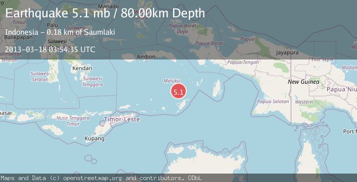
A 5.1 magnitude earthquake struck on KEP. TANIMBAR REGION, INDONESIA, at Mon, 18 Mar 2013 03:54:35 GMT. Depth: 80km. Reviewed by EMSC seismologists, this moderate quake occurred at a magnitude type of mb.
Magnitude
5.1
mb
Source
EMSC
Intensity
-
Agency Reports
1 Sources| Source | Magnitude | Depth | Time |
|---|---|---|---|
| EMSCPrimary | 5.1 | 80 km | 12 years ago |
Earthquake Details
AutomaticEvent IDemsc_EMSC_20130318_0000008
Tsunami PotentialNo
Magnitude Typemb
Nearest Places
- Weber Basin44.8 km
- Kepulauan Selatan Daya51.1 km
- Wulmasa65.0 km
- Tanjung Nituwahan65.3 km
- Nuhututul65.5 km
Comments
Join the discussion about this event.
Latest Earthquakes
1.4Mag
EASTERN TURKEY
Time7 minutes ago
Depth6.80 km
SourceAFAD (Automatic)
1.7Mag
northern Alaska
Time8 minutes ago
Depth4.64 km
SourceVYT (Automatic)
1.2Mag
5 km WNW of The Geysers, CA
Time14 minutes ago
Depth3.19 km
SourceUSGS (Automatic)
3.4Mag
Sulawesi, Indonesia
Time17 minutes ago
Depth27.95 km
SourceVYT (Automatic)
1.6Mag
Central Alaska
Time18 minutes ago
Depth18.07 km
SourceVYT (Automatic)
Nearby Earthquakes
3.5Mag
KEP. TANIMBAR REGION, INDONESIA
Time2 weeks ago
Depth14.00 km
SourceBMKG (Automatic)
5.2Mag
KEP. TANIMBAR REGION, INDONESIA
Time8 years ago
Depth73.00 km
SourceEMSC (Automatic)
3.4Mag
Tanimbar Islands Region, Indonesia
Time2 days ago
Depth161.23 km
SourceBMKG
5.6Mag
BANDA SEA
Time3 months ago
Depth91.50 km
SourceEMSC (Automatic)
5.1Mag
KEP. TANIMBAR REGION, INDONESIA
Time12 years ago
Depth90.00 km
SourceEMSC (Automatic)