Earthquake MOLUCCA SEA
Wed, 10 Sep 2014 05:19:25 GMT
Time11 years ago
Location
-0.1600, 125.1400
Depth
54.0 KM
Event Summary
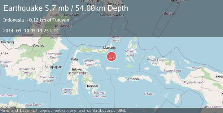
A 5.7 magnitude earthquake struck on MOLUCCA SEA, at Wed, 10 Sep 2014 05:19:25 GMT. Depth: 54km. Reviewed by EMSC seismologists, this moderate quake occurred at a magnitude type of mb.
Magnitude
5.7
mb
Source
EMSC
Intensity
-
Agency Reports
1 Sources| Source | Magnitude | Depth | Time |
|---|---|---|---|
| EMSCPrimary | 5.7 | 50 km | 11 years ago |
Earthquake Details
AutomaticEvent IDemsc_EMSC_20140910_0000016
Tsunami PotentialNo
Magnitude Typemb
Nearest Places
- Batu Mandi97.9 km
- Tanjung Flesko99.1 km
- Tanjung Palureoi99.6 km
- Pulau Lampu99.9 km
- Tanjung Payongan100.4 km
Comments
Join the discussion about this event.
Latest Earthquakes
2.8Mag
West Papua Region, Indonesia
Time3 minutes ago
Depth34.12 km
SourceBMKG
2.6Mag
Java, Indonesia
Time13 minutes ago
Depth214.22 km
SourceBMKG
1.0Mag
Southeastern Alaska
Time14 minutes ago
Depth0.00 km
SourceVYT (Automatic)
3.5Mag
COOK STRAIT, NEW ZEALAND
Time15 minutes ago
Depth75.30 km
SourceGNS (Automatic)
2.5Mag
Seram, Indonesia
Time17 minutes ago
Depth21.28 km
SourceBMKG
Nearby Earthquakes
5.0Mag
MOLUCCA SEA
Time15 years ago
Depth64.00 km
SourceEMSC (Automatic)
5.8Mag
MOLUCCA SEA
Time1 year ago
Depth39.70 km
SourceEMSC (Automatic)
5.2Mag
MOLUCCA SEA
Time15 years ago
Depth51.00 km
SourceEMSC (Automatic)
5.2Mag
MOLUCCA SEA
Time11 years ago
Depth52.00 km
SourceEMSC (Automatic)
5.5Mag
MOLUCCA SEA
Time8 years ago
Depth50.00 km
SourceEMSC (Automatic)