Earthquake KERMADEC ISLANDS REGION
Thu, 29 Jun 2017 07:03:09 GMT
Time8 years ago
Location
-31.1100, 179.9800
Depth
386.0 KM
Event Summary
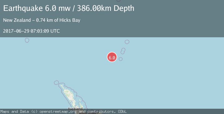
A 6.0 magnitude earthquake struck on KERMADEC ISLANDS REGION, at Thu, 29 Jun 2017 07:03:09 GMT. Depth: 386km. Reviewed by EMSC seismologists, this strong quake occurred at a magnitude type of mw.
Magnitude
6.0
mw
Source
EMSC
Intensity
-
Agency Reports
1 Sources| Source | Magnitude | Depth | Time |
|---|---|---|---|
| EMSCPrimary | 6.0 | 386 km | 8 years ago |
Earthquake Details
AutomaticEvent IDemsc_EMSC_20170629_0000030
Tsunami PotentialNo
Magnitude Typemw
Nearest Places
- Havre Trough65.7 km
- Havre Seamount92.3 km
- Havre Rock100.6 km
- L'Esperance Rock112.3 km
- Colville Ridge123.4 km
Comments
Join the discussion about this event.
Latest Earthquakes
1.9Mag
6 km NW of Pinnacles, CA
Time2 minutes ago
Depth4.82 km
SourceUSGS (Automatic)
1.2Mag
Southern Yukon Territory, Canada
Time14 minutes ago
Depth0.00 km
SourceVYT (Automatic)
3.6Mag
Jujuy, Argentina
Time14 minutes ago
Depth228.27 km
SourceVYT (Automatic)
1.3Mag
2 km N of The Geysers, CA
Time22 minutes ago
Depth0.17 km
SourceUSGS (Automatic)
1.6Mag
3 km ESE of Berkeley, CA
Time23 minutes ago
Depth9.87 km
SourceUSGS (Automatic)
Nearby Earthquakes
6.2Mag
KERMADEC ISLANDS REGION
Time10 years ago
Depth382.00 km
SourceEMSC (Automatic)
5.3Mag
KERMADEC ISLANDS REGION
Time18 years ago
Depth277.00 km
SourceEMSC (Automatic)
5.6Mag
KERMADEC ISLANDS REGION
Time14 years ago
Depth313.00 km
SourceEMSC (Automatic)
5.0Mag
KERMADEC ISLANDS REGION
Time10 years ago
Depth166.00 km
SourceGNS (Automatic)
4.0Mag
KERMADEC ISLANDS REGION
Time3 years ago
Depth395.00 km
SourceNEIC (Automatic)