Earthquake KERMADEC ISLANDS REGION
Mon, 07 Aug 2017 13:24:02 GMT
Time8 years ago
Location
-31.9000, -178.4700
Depth
30.0 KM
Event Summary
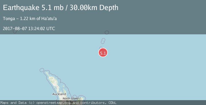
A 5.1 magnitude earthquake struck on KERMADEC ISLANDS REGION, at Mon, 07 Aug 2017 13:24:02 GMT. Depth: 30km. Reviewed by EMSC seismologists, this moderate quake occurred at a magnitude type of mb.
Magnitude
5.1
mb
Source
EMSC
Intensity
-
Agency Reports
1 Sources| Source | Magnitude | Depth | Time |
|---|---|---|---|
| EMSCPrimary | 5.1 | 30 km | 8 years ago |
Earthquake Details
AutomaticEvent IDemsc_EMSC_20170807_0000079
Tsunami PotentialNo
Magnitude Typemb
Nearest Places
- L'Esperance Rock66.0 km
- Havre Rock79.1 km
- Star of Bengal Bank82.6 km
- Havre Seamount104.7 km
- Havre Trough107.1 km
Comments
Join the discussion about this event.
Latest Earthquakes
2.7Mag
Alaska Peninsula
Time13 minutes ago
Depth7.08 km
SourceVYT (Automatic)
2.4Mag
HAWAII REGION, HAWAII
Time14 minutes ago
Depth11.20 km
SourceHV (Automatic)
3.1Mag
Potosi, Bolivia
Time18 minutes ago
Depth330.08 km
SourceVYT (Automatic)
1.6Mag
EASTERN TURKEY
Time25 minutes ago
Depth19.50 km
SourceAFAD (Automatic)
1.4Mag
4 km W of Lake Henshaw, CA
Time25 minutes ago
Depth12.20 km
SourceUSGS (Automatic)
Nearby Earthquakes
4.4Mag
KERMADEC ISLANDS REGION
Time3 weeks ago
Depth35.00 km
SourceNEIC (Automatic)
5.2Mag
KERMADEC ISLANDS REGION
Time6 years ago
Depth16.00 km
SourceEMSC (Automatic)
5.1Mag
KERMADEC ISLANDS REGION
Time7 years ago
Depth10.00 km
SourceEMSC (Automatic)
5.1Mag
KERMADEC ISLANDS REGION
Time12 years ago
Depth40.00 km
SourceEMSC (Automatic)
5.2Mag
KERMADEC ISLANDS REGION
Time19 years ago
Depth33.00 km
SourceEMSC (Automatic)