Earthquake KERMADEC ISLANDS REGION
Wed, 28 Jan 2026 09:40:09 GMT
Time3 weeks ago
Location
-31.9140, -178.4041
Depth
35.0 KM
Event Summary
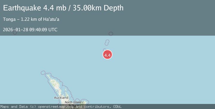
A 4.4 magnitude earthquake struck on KERMADEC ISLANDS REGION, at Wed, 28 Jan 2026 09:40:09 GMT. Depth: 35km. Reviewed by NEIC seismologists, this light quake occurred at a magnitude type of mb.
Magnitude
4.4
mb
Source
NEIC
Intensity
-
Agency Reports
1 Sources| Source | Magnitude | Depth | Time |
|---|---|---|---|
| NEICPrimary | 4.4 | 35 km | 3 weeks ago |
Earthquake Details
AutomaticEvent IDemsc_NEIC_20260128_0000467
Tsunami PotentialNo
Magnitude Typemb
Nearest Places
- L'Esperance Rock71.1 km
- Havre Rock84.4 km
- Star of Bengal Bank86.1 km
- Scholl Deep104.6 km
- Havre Seamount109.4 km
Comments
Join the discussion about this event.
Latest Earthquakes
1.7Mag
British Columbia, Canada
Time3 minutes ago
Depth11.60 km
SourceVYT (Automatic)
2.1Mag
WESTERN TURKEY
Time7 minutes ago
Depth4.90 km
SourceKOERI (Automatic)
3.3Mag
Sumba region, Indonesia
Time18 minutes ago
Depth17.09 km
SourceVYT (Automatic)
3.2Mag
West Papua Region, Indonesia
Time19 minutes ago
Depth10.00 km
SourceBMKG
1.4Mag
Southeastern Alaska
Time21 minutes ago
Depth0.00 km
SourceVYT (Automatic)
Nearby Earthquakes
5.1Mag
KERMADEC ISLANDS REGION
Time8 years ago
Depth30.00 km
SourceEMSC (Automatic)
5.1Mag
KERMADEC ISLANDS REGION
Time12 years ago
Depth40.00 km
SourceEMSC (Automatic)
5.0Mag
SOUTH OF KERMADEC ISLANDS
Time12 years ago
Depth10.00 km
SourceGFZ (Automatic)
5.2Mag
KERMADEC ISLANDS REGION
Time1 year ago
Depth48.00 km
SourceEMSC (Automatic)
5.2Mag
SOUTH OF KERMADEC ISLANDS
Time17 years ago
Depth2.00 km
SourceEMSC (Automatic)