Earthquake SOUTH OF KERMADEC ISLANDS
Thu, 28 Sep 2017 22:47:11 GMT
Time8 years ago
Location
-33.9600, -178.5400
Depth
10.0 KM
Event Summary
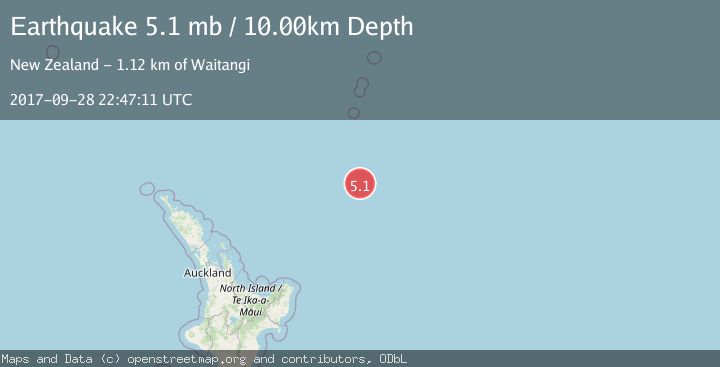
A 5.1 magnitude earthquake struck on SOUTH OF KERMADEC ISLANDS, at Thu, 28 Sep 2017 22:47:11 GMT. Depth: 10km. Reviewed by EMSC seismologists, this moderate quake occurred at a magnitude type of mb.
Magnitude
5.1
mb
Source
EMSC
Intensity
-
Agency Reports
1 Sources| Source | Magnitude | Depth | Time |
|---|---|---|---|
| EMSCPrimary | 5.1 | 10 km | 8 years ago |
Earthquake Details
AutomaticEvent IDemsc_EMSC_20170928_0000112
Tsunami PotentialNo
Magnitude Typemb
Nearest Places
- Kuiwai Seamount155.5 km
- Ngātoroirangi Seamount155.6 km
- Star of Bengal Bank179.3 km
- Haungaroa Seamount180.4 km
- Speight Knoll200.3 km
Comments
Join the discussion about this event.
Latest Earthquakes
0.7Mag
7 km WNW of Cobb, CA
Time4 minutes ago
Depth1.75 km
SourceUSGS (Automatic)
1.2Mag
9 km N of Banning, CA
Time5 minutes ago
Depth18.03 km
SourceUSGS (Automatic)
2.1Mag
Southern California
Time6 minutes ago
Depth8.54 km
SourceVYT (Automatic)
2.2Mag
Sweden
Time10 minutes ago
Depth0.00 km
SourceVYT (Automatic)
2.6Mag
West Papua Region, Indonesia
Time13 minutes ago
Depth14.47 km
SourceBMKG
Nearby Earthquakes
5.3Mag
SOUTH OF KERMADEC ISLANDS
Time3 years ago
Depth10.00 km
SourceEMSC (Automatic)
5.1Mag
SOUTH OF KERMADEC ISLANDS
Time4 months ago
Depth10.00 km
SourceEMSC (Automatic)
5.0Mag
SOUTH OF KERMADEC ISLANDS
Time18 years ago
Depth40.00 km
SourceEMSC (Automatic)
5.1Mag
SOUTH OF KERMADEC ISLANDS
Time4 months ago
Depth10.00 km
SourceEMSC (Automatic)
5.3Mag
SOUTH OF KERMADEC ISLANDS
Time15 years ago
Depth10.00 km
SourceEMSC (Automatic)