Earthquake SOUTH OF KERMADEC ISLANDS
Wed, 27 Feb 2008 04:54:26 GMT
Time17 years ago
Location
-34.7400, -178.6700
Depth
40.0 KM
Event Summary
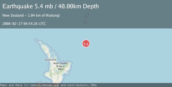
A 5.4 magnitude earthquake struck on SOUTH OF KERMADEC ISLANDS, at Wed, 27 Feb 2008 04:54:26 GMT. Depth: 40km. Reviewed by EMSC seismologists, this moderate quake occurred at a magnitude type of mb.
Magnitude
5.4
mb
Source
EMSC
Intensity
-
Agency Reports
1 Sources| Source | Magnitude | Depth | Time |
|---|---|---|---|
| EMSCPrimary | 5.4 | 40 km | 17 years ago |
Earthquake Details
AutomaticEvent IDemsc_EMSC_20080227_0000062
Tsunami PotentialNo
Magnitude Typemb
Nearest Places
- Ngātoroirangi Seamount179.8 km
- Kibblewhite Seamount189.3 km
- Brothers Seamount207.8 km
- Kuiwai Seamount209.8 km
- James Healy Seamount215.6 km
Comments
Join the discussion about this event.
Latest Earthquakes
0.7Mag
7 km WNW of Cobb, CA
Time4 minutes ago
Depth1.75 km
SourceUSGS (Automatic)
1.2Mag
9 km N of Banning, CA
Time6 minutes ago
Depth18.03 km
SourceUSGS (Automatic)
2.1Mag
Southern California
Time7 minutes ago
Depth8.54 km
SourceVYT (Automatic)
2.2Mag
Sweden
Time11 minutes ago
Depth0.00 km
SourceVYT (Automatic)
2.6Mag
West Papua Region, Indonesia
Time14 minutes ago
Depth14.47 km
SourceBMKG
Nearby Earthquakes
5.0Mag
SOUTH OF KERMADEC ISLANDS
Time6 years ago
Depth10.00 km
SourceGFZ (Automatic)
5.5Mag
SOUTH OF KERMADEC ISLANDS
Time9 years ago
Depth10.00 km
SourceEMSC (Automatic)
5.5Mag
SOUTH OF KERMADEC ISLANDS
Time7 years ago
Depth10.00 km
SourceEMSC (Automatic)
6.2Mag
SOUTH OF KERMADEC ISLANDS
Time7 years ago
Depth10.00 km
SourceEMSC (Automatic)
5.3Mag
SOUTH OF KERMADEC ISLANDS
Time16 years ago
Depth2.00 km
SourceEMSC (Automatic)