Earthquake TIMOR REGION, INDONESIA
Fri, 14 Aug 2020 13:21:39 GMT
Time5 years ago
Location
-10.3300, 124.2800
Depth
30.0 KM
Event Summary
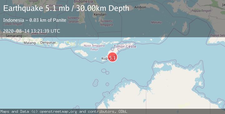
A 5.1 magnitude earthquake struck on TIMOR REGION, INDONESIA, at Fri, 14 Aug 2020 13:21:39 GMT. Depth: 30km. Reviewed by EMSC seismologists, this moderate quake occurred at a magnitude type of mb.
Magnitude
5.1
mb
Source
EMSC
Intensity
-
Agency Reports
1 Sources| Source | Magnitude | Depth | Time |
|---|---|---|---|
| EMSCPrimary | 5.1 | 30 km | 5 years ago |
Earthquake Details
AutomaticEvent IDemsc_EMSC_20200814_0000091
Tsunami PotentialNo
Magnitude Typemb
Nearest Places
- Oesuenu18.6 km
- Nifu Kubai19.0 km
- Noel Mina20.2 km
- Teluk Noilmina20.3 km
- Tanjung Ela22.4 km
Comments
Join the discussion about this event.
Latest Earthquakes
2.6Mag
Antofagasta, Chile
Time1 minute ago
Depth67.26 km
SourceVYT (Automatic)
1.8Mag
northern Alaska
Time4 minutes ago
Depth223.88 km
SourceVYT (Automatic)
3.0Mag
Java, Indonesia
Time5 minutes ago
Depth29.78 km
SourceBMKG
2.4Mag
Finland-Russia border region
Time6 minutes ago
Depth341.92 km
SourceVYT (Automatic)
0.9Mag
8 km W of Cobb, CA
Time11 minutes ago
Depth1.53 km
SourceUSGS (Automatic)
Nearby Earthquakes
2.5Mag
Timor Region
Time1 day ago
Depth49.89 km
SourceBMKG
2.2Mag
Timor Region
Time2 weeks ago
Depth5.01 km
SourceBMKG (Automatic)
3.0Mag
TIMOR REGION, INDONESIA
Time6 years ago
Depth13.00 km
SourceDJA (Automatic)
2.5Mag
TIMOR REGION, INDONESIA
Time1 month ago
Depth5.00 km
SourceBMKG (Automatic)
3.0Mag
TIMOR REGION, INDONESIA
Time5 years ago
Depth10.00 km
SourceDJA (Automatic)