Earthquake Timor Region
Tue, 17 Feb 2026 00:03:56 GMT
Time1 day ago
Location
-10.2473, 124.2176
Depth
49.9 KM
Event Summary
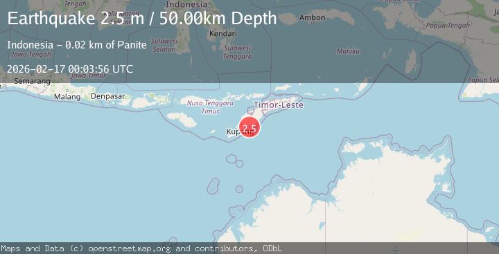
A 2.5 magnitude earthquake struck on Timor Region, at Tue, 17 Feb 2026 00:03:56 GMT. Depth: 49.890675km. Reviewed by BMKG seismologists, this minor quake occurred at a magnitude type of M.
Magnitude
2.5
M
Source
BMKG
Intensity
-
Agency Reports
1 Sources| Source | Magnitude | Depth | Time |
|---|---|---|---|
| BMKGPrimary | 2.5 | 50 km | 1 day ago |
Earthquake Details
ManualEvent IDbmg2026dhwu
Tsunami PotentialNo
Magnitude TypeM
Nearest Places
- Teluk Noilmina9.1 km
- Noel Mina9.6 km
- Nifu Kubai10.1 km
- Muara Fefa11.5 km
- Nikis12.3 km
Comments
Join the discussion about this event.
Latest Earthquakes
2.5Mag
Java, Indonesia
Time13 hours ago
Depth19.23 km
SourceBMKG
2.2Mag
Seram, Indonesia
Time13 hours ago
Depth19.61 km
SourceBMKG
2.2Mag
Sweden
Time13 hours ago
Depth0.00 km
SourceVYT (Automatic)
1.5Mag
Southeastern Alaska
Time13 hours ago
Depth0.00 km
SourceVYT (Automatic)
1.6Mag
5 km NNW of Boron, CA
Time13 hours ago
Depth-0.63 km
SourceUSGS (Automatic)
Nearby Earthquakes
3.0Mag
TIMOR REGION, INDONESIA
Time5 years ago
Depth10.00 km
SourceDJA (Automatic)
5.1Mag
TIMOR REGION, INDONESIA
Time5 years ago
Depth30.00 km
SourceEMSC (Automatic)
2.2Mag
Timor Region
Time2 weeks ago
Depth5.01 km
SourceBMKG (Automatic)
2.9Mag
Timor Region
Time2 weeks ago
Depth14.59 km
SourceBMKG (Automatic)
5.7Mag
TIMOR REGION, INDONESIA
Time6 years ago
Depth10.00 km
SourceEMSC (Automatic)