Earthquake MORO GULF, MINDANAO, PHILIPPINES
Sun, 16 Aug 2020 07:22:30 GMT
Time5 years ago
Location
6.4900, 123.4900
Depth
586.0 KM
Event Summary
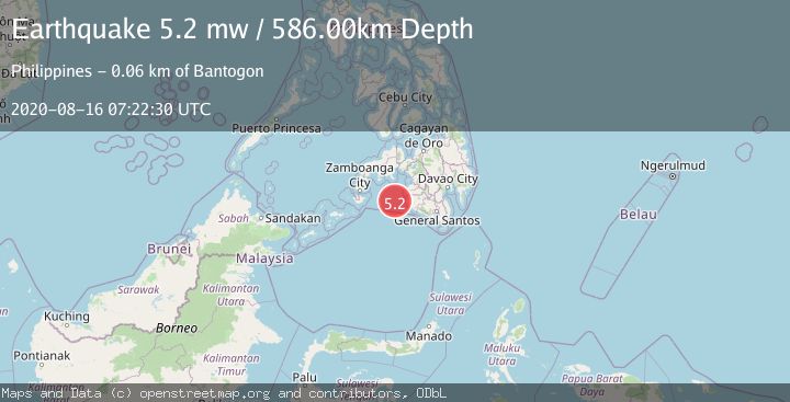
A 5.2 magnitude earthquake struck on MORO GULF, MINDANAO, PHILIPPINES, at Sun, 16 Aug 2020 07:22:30 GMT. Depth: 586km. Reviewed by EMSC seismologists, this moderate quake occurred at a magnitude type of mw.
Magnitude
5.2
mw
Source
EMSC
Intensity
-
Agency Reports
1 Sources| Source | Magnitude | Depth | Time |
|---|---|---|---|
| EMSCPrimary | 5.2 | 586 km | 5 years ago |
Earthquake Details
AutomaticEvent IDemsc_EMSC_20200816_0000045
Tsunami PotentialNo
Magnitude Typemw
Nearest Places
- 54.9 km
- 58.3 km
- 58.8 km
- 58.9 km
- 59.3 km
Comments
Join the discussion about this event.
Latest Earthquakes
0.7Mag
19 km ESE of Little Lake, CA
Time18 hours ago
Depth2.33 km
SourceUSGS (Automatic)
1.3Mag
4 km W of Cobb, CA
Time18 hours ago
Depth1.89 km
SourceUSGS (Automatic)
2.2Mag
Sumbawa Region, Indonesia
Time18 hours ago
Depth16.37 km
SourceBMKG
1.0Mag
Northern Territory, Australia
Time18 hours ago
Depth4.27 km
SourceVYT (Automatic)
3.8Mag
Fox Islands, Aleutian Islands, Alaska
Time18 hours ago
Depth0.00 km
SourceVYT (Automatic)
Nearby Earthquakes
5.0Mag
MORO GULF, MINDANAO, PHILIPPINES
Time13 years ago
Depth622.00 km
SourceEMSC (Automatic)
5.0Mag
MORO GULF, MINDANAO, PHILIPPINES
Time3 weeks ago
Depth10.00 km
SourceNEIC (Automatic)
5.2Mag
MORO GULF, MINDANAO, PHILIPPINES
Time15 years ago
Depth591.00 km
SourceEMSC (Automatic)
5.1Mag
MORO GULF, MINDANAO, PHILIPPINES
Time15 years ago
Depth632.00 km
SourceEMSC (Automatic)
3.0Mag
MORO GULF, MINDANAO, PHILIPPINES
Time2 weeks ago
Depth16.00 km
SourcePIVS (Automatic)