Earthquake MOLUCCA SEA
Fri, 18 Sep 2020 18:43:25 GMT
Time5 years ago
Location
2.4400, 126.9000
Depth
15.0 KM
Event Summary
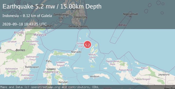
A 5.2 magnitude earthquake struck on MOLUCCA SEA, at Fri, 18 Sep 2020 18:43:25 GMT. Depth: 15km. Reviewed by EMSC seismologists, this moderate quake occurred at a magnitude type of mw.
Magnitude
5.2
mw
Source
EMSC
Intensity
-
Agency Reports
1 Sources| Source | Magnitude | Depth | Time |
|---|---|---|---|
| EMSCPrimary | 5.2 | 15 km | 5 years ago |
Earthquake Details
AutomaticEvent IDemsc_EMSC_20200918_0000143
Tsunami PotentialNo
Magnitude Typemw
Nearest Places
- Pulau Laba94.0 km
- Tanjung Gurama95.2 km
- Pulau Deherete95.3 km
- Desa Jikolamo96.7 km
- Jikolamo97.3 km
Comments
Join the discussion about this event.
Latest Earthquakes
2.7Mag
Near North Coast of West Papua
Time13 minutes ago
Depth45.06 km
SourceBMKG
1.2Mag
Central Alaska
Time14 minutes ago
Depth0.85 km
SourceVYT (Automatic)
2.6Mag
West Papua Region, Indonesia
Time17 minutes ago
Depth10.00 km
SourceBMKG
2.3Mag
WESTERN TURKEY
Time20 minutes ago
Depth10.10 km
SourceKOERI (Automatic)
2.6Mag
Antofagasta, Chile
Time21 minutes ago
Depth0.00 km
SourceVYT (Automatic)
Nearby Earthquakes
3.1Mag
MOLUCCA SEA
Time1 month ago
Depth75.00 km
SourceBMKG (Automatic)
3.4Mag
MOLUCCA SEA
Time1 month ago
Depth29.00 km
SourceBMKG (Automatic)
4.0Mag
MOLUCCA SEA
Time7 years ago
Depth10.00 km
SourceDJA (Automatic)
3.0Mag
Northern Molucca Sea
Time4 days ago
Depth10.00 km
SourceBMKG
5.0Mag
MOLUCCA SEA
Time4 years ago
Depth10.00 km
SourceEMSC (Automatic)