Earthquake SOUTH OF KERMADEC ISLANDS
Fri, 18 Dec 2020 20:49:13 GMT
Time5 years ago
Location
-32.7300, -178.7600
Depth
30.0 KM
Event Summary
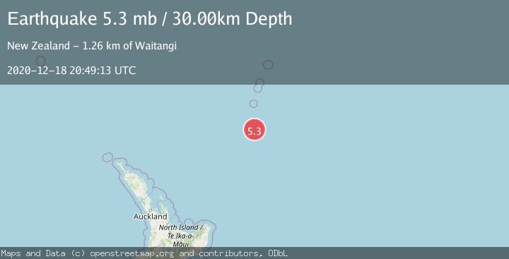
A 5.3 magnitude earthquake struck on SOUTH OF KERMADEC ISLANDS, at Fri, 18 Dec 2020 20:49:13 GMT. Depth: 30km. Reviewed by EMSC seismologists, this moderate quake occurred at a magnitude type of mb.
Magnitude
5.3
mb
Source
EMSC
Intensity
-
Agency Reports
1 Sources| Source | Magnitude | Depth | Time |
|---|---|---|---|
| EMSCPrimary | 5.3 | 30 km | 5 years ago |
Earthquake Details
AutomaticEvent IDemsc_EMSC_20201218_0000168
Tsunami PotentialNo
Magnitude Typemb
Nearest Places
- Star of Bengal Bank47.2 km
- Haungaroa Seamount82.7 km
- Speight Knoll86.5 km
- Oliver Knoll93.3 km
- Kuiwai Seamount118.6 km
Comments
Join the discussion about this event.
Latest Earthquakes
0.9Mag
6 km NNE of Corralitos, CA
Time2 minutes ago
Depth6.95 km
SourceUSGS (Automatic)
4.4Mag
north of Halmahera, Indonesia
Time9 minutes ago
Depth10.00 km
SourceVYT (Automatic)
4.4Mag
NORTH OF HALMAHERA, INDONESIA
Time9 minutes ago
Depth10.00 km
SourceBMKG (Automatic)
3.1Mag
Sulawesi, Indonesia
Time11 minutes ago
Depth0.00 km
SourceVYT (Automatic)
1.9Mag
Southeastern Alaska
Time14 minutes ago
Depth17.82 km
SourceVYT (Automatic)
Nearby Earthquakes
5.1Mag
SOUTH OF KERMADEC ISLANDS
Time19 years ago
Depth30.00 km
SourceEMSC (Automatic)
5.4Mag
SOUTH OF KERMADEC ISLANDS
Time19 years ago
Depth30.00 km
SourceEMSC (Automatic)
5.1Mag
SOUTH OF KERMADEC ISLANDS
Time6 years ago
Depth30.00 km
SourceEMSC (Automatic)
4.0Mag
SOUTH OF KERMADEC ISLANDS
Time4 years ago
Depth35.00 km
SourceNEIC (Automatic)
4.0Mag
SOUTH OF KERMADEC ISLANDS
Time2 years ago
Depth35.00 km
SourceNEIC (Automatic)