Earthquake PHILIPPINE ISLANDS REGION
Mon, 08 Feb 2021 00:00:43 GMT
Time5 years ago
Location
5.7100, 127.1000
Depth
60.0 KM
Event Summary
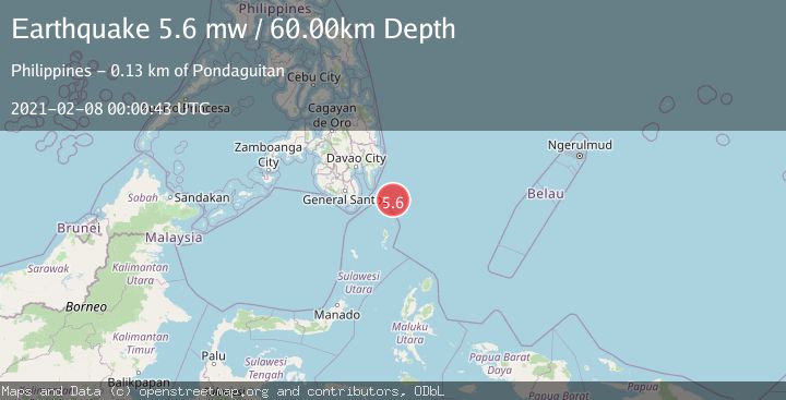
A 5.6 magnitude earthquake struck on PHILIPPINE ISLANDS REGION, at Mon, 08 Feb 2021 00:00:43 GMT. Depth: 60km. Reviewed by EMSC seismologists, this moderate quake occurred at a magnitude type of mw.
Magnitude
5.6
mw
Source
EMSC
Intensity
-
Agency Reports
1 Sources| Source | Magnitude | Depth | Time |
|---|---|---|---|
| EMSCPrimary | 5.6 | 60 km | 5 years ago |
Earthquake Details
AutomaticEvent IDemsc_EMSC_20210208_0000003
Tsunami PotentialNo
Magnitude Typemw
Nearest Places
- Tanjung Dapapa58.7 km
- Desa Pulau Miangas59.6 km
- Kecamatan Miangas59.6 km
- Pulau Miangas59.6 km
- Miangas60.2 km
Comments
Join the discussion about this event.
Latest Earthquakes
3.4Mag
southern Peru
Time3 minutes ago
Depth204.47 km
SourceVYT (Automatic)
2.1Mag
SAN FRANCISCO BAY AREA, CALIF.
Time5 minutes ago
Depth6.40 km
SourceNC (Automatic)
2.4Mag
Fox Islands, Aleutian Islands, Alaska
Time6 minutes ago
Depth44.43 km
SourceVYT (Automatic)
2.4Mag
British Columbia, Canada
Time6 minutes ago
Depth3.91 km
SourceVYT (Automatic)
2.1Mag
Near North Coast of West Papua
Time6 minutes ago
Depth11.10 km
SourceBMKG
Nearby Earthquakes
5.0Mag
PHILIPPINE ISLANDS REGION
Time4 years ago
Depth60.00 km
SourceEMSC (Automatic)
5.6Mag
PHILIPPINE ISLANDS REGION
Time8 years ago
Depth69.00 km
SourceEMSC (Automatic)
3.0Mag
PHILIPPINE ISLANDS REGION
Time2 years ago
Depth63.00 km
SourcePIVS (Automatic)
3.0Mag
PHILIPPINE ISLANDS REGION
Time2 years ago
Depth69.00 km
SourcePIVS (Automatic)
3.0Mag
PHILIPPINE ISLANDS REGION
Time2 years ago
Depth122.00 km
SourcePIVS (Automatic)