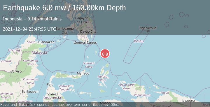
Earthquake NORTH OF HALMAHERA, INDONESIA
Sat, 04 Dec 2021 23:47:55 GMT
Time4 years ago
Location
4.1000, 128.1600
Depth
160.0 KM
Event Summary
A 6.0 magnitude earthquake struck on NORTH OF HALMAHERA, INDONESIA, at Sat, 04 Dec 2021 23:47:55 GMT. Depth: 160km. Reviewed by EMSC seismologists, this strong quake occurred at a magnitude type of mw.
Magnitude
6.0
mw
Source
EMSC
Intensity
-
Agency Reports
1 Sources| Source | Magnitude | Depth | Time |
|---|---|---|---|
| EMSCPrimary | 6.0 | 160 km | 4 years ago |
Earthquake Details
AutomaticEvent IDemsc_EMSC_20211204_0000224
Tsunami PotentialNo
Magnitude Typemw
Nearest Places
- Snellius Ridge20.9 km
- Talaud Trough83.2 km
- Pulau Karis115.2 km
- Morotai Basin123.6 km
- Pulau Kakorotan125.4 km
Comments
Join the discussion about this event.
Latest Earthquakes
2.8Mag
Sulawesi, Indonesia
Time3 minutes ago
Depth21.08 km
SourceBMKG
2.1Mag
WESTERN TURKEY
Time7 minutes ago
Depth12.30 km
SourceKOERI (Automatic)
2.2Mag
Alaska Peninsula
Time7 minutes ago
Depth57.74 km
SourceVYT (Automatic)
3.8Mag
WESTERN TURKEY
Time10 minutes ago
Depth13.30 km
SourceKOERI (Automatic)
1.6Mag
27 km ESE of Balmorhea, Texas
Time10 minutes ago
Depth3.56 km
SourceUSGS (Automatic)
Nearby Earthquakes
4.9Mag
north of Halmahera, Indonesia
Time3 days ago
Depth10.00 km
SourceVYT (Automatic)
5.0Mag
NORTH OF HALMAHERA, INDONESIA
Time12 years ago
Depth70.00 km
SourceEMSC (Automatic)
3.9Mag
North of Halmahera, Indonesia
Time3 days ago
Depth9.91 km
SourceBMKG
5.8Mag
NORTH OF HALMAHERA, INDONESIA
Time21 years ago
Depth33.00 km
SourceEMSC (Automatic)
4.5Mag
north of Halmahera, Indonesia
Time3 days ago
Depth10.00 km
SourceVYT (Automatic)