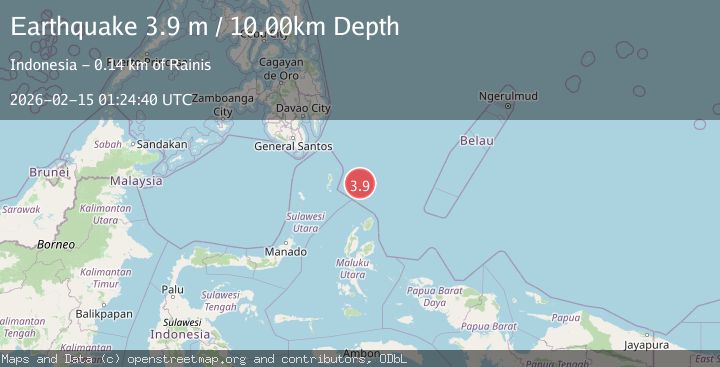
Earthquake North of Halmahera, Indonesia
Sun, 15 Feb 2026 01:24:40 GMT
Time3 days ago
Location
4.0917, 128.1271
Depth
9.9 KM
Event Summary
A 3.9 magnitude earthquake struck on North of Halmahera, Indonesia, at Sun, 15 Feb 2026 01:24:40 GMT. Depth: 9.90635km. Reviewed by BMKG seismologists, this minor quake occurred at a magnitude type of M.
Magnitude
3.9
M
Source
BMKG
Intensity
-
Agency Reports
1 Sources| Source | Magnitude | Depth | Time |
|---|---|---|---|
| BMKGPrimary | 3.9 | 10 km | 3 days ago |
Earthquake Details
ManualEvent IDbmg2026deil
Tsunami PotentialNo
Magnitude TypeM
Nearest Places
- Snellius Ridge17.4 km
- Talaud Trough79.5 km
- Pulau Karis112.2 km
- Morotai Basin122.2 km
- Pulau Kakorotan122.7 km
Comments
Join the discussion about this event.
Latest Earthquakes
2.1Mag
Sweden
Time5 hours ago
Depth7.08 km
SourceVYT (Automatic)
2.3Mag
Alaska Peninsula
Time5 hours ago
Depth113.04 km
SourceVYT (Automatic)
2.2Mag
Northern Sumatra, Indonesia
Time5 hours ago
Depth6.04 km
SourceBMKG
2.6Mag
Java, Indonesia
Time5 hours ago
Depth16.25 km
SourceBMKG
1.0Mag
Southeastern Alaska
Time5 hours ago
Depth0.00 km
SourceVYT (Automatic)
Nearby Earthquakes
5.0Mag
NORTH OF HALMAHERA, INDONESIA
Time12 years ago
Depth70.00 km
SourceEMSC (Automatic)
6.0Mag
NORTH OF HALMAHERA, INDONESIA
Time4 years ago
Depth160.00 km
SourceEMSC (Automatic)
5.8Mag
NORTH OF HALMAHERA, INDONESIA
Time21 years ago
Depth33.00 km
SourceEMSC (Automatic)
4.9Mag
north of Halmahera, Indonesia
Time3 days ago
Depth10.00 km
SourceVYT (Automatic)
4.5Mag
north of Halmahera, Indonesia
Time3 days ago
Depth10.00 km
SourceVYT (Automatic)