Earthquake MOLUCCA SEA
Tue, 16 Jul 2024 23:39:35 GMT
Time1 year ago
Location
1.2404, 126.1362
Depth
58.0 KM
Event Summary
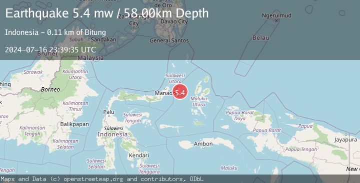
A 5.4 magnitude earthquake struck on MOLUCCA SEA, at Tue, 16 Jul 2024 23:39:35 GMT. Depth: 58km. Reviewed by EMSC seismologists, this moderate quake occurred at a magnitude type of mw.
Magnitude
5.4
mw
Source
EMSC
Intensity
-
Agency Reports
1 Sources| Source | Magnitude | Depth | Time |
|---|---|---|---|
| EMSCPrimary | 5.4 | 58 km | 1 year ago |
Earthquake Details
AutomaticEvent IDemsc_EMSC_20240716_0000270
Tsunami PotentialNo
Magnitude Typemw
Nearest Places
- Kelurahan Perum Bersatu26.5 km
- Pasirputih26.7 km
- Tanjung Geranomaderi27.6 km
- Pulau Gureda28.2 km
- Kelurahan Lelewi28.5 km
Comments
Join the discussion about this event.
Latest Earthquakes
0.7Mag
8 km NW of The Geysers, CA
Time7 minutes ago
Depth1.59 km
SourceUSGS (Automatic)
1.2Mag
Southern Alaska
Time8 minutes ago
Depth16.72 km
SourceVYT (Automatic)
1.6Mag
49 km W of Mentone, Texas
Time8 minutes ago
Depth4.59 km
SourceUSGS (Automatic)
3.1Mag
northern Colombia
Time10 minutes ago
Depth219.97 km
SourceVYT (Automatic)
2.2Mag
Sumbawa Region, Indonesia
Time13 minutes ago
Depth15.54 km
SourceBMKG
Nearby Earthquakes
3.0Mag
MOLUCCA SEA
Time2 years ago
Depth10.00 km
SourceBMKG (Automatic)
3.1Mag
Northern Molucca Sea
Time3 weeks ago
Depth14.98 km
SourceBMKG (Automatic)
3.0Mag
MOLUCCA SEA
Time4 years ago
Depth10.00 km
SourceDJA (Automatic)
3.0Mag
MOLUCCA SEA
Time10 months ago
Depth25.00 km
SourceBMKG (Automatic)
3.0Mag
MOLUCCA SEA
Time4 years ago
Depth10.00 km
SourceDJA (Automatic)