Earthquake PERU-ECUADOR BORDER REGION
Thu, 08 Jan 2026 05:17:50 GMT
Time3 months ago
Location
-3.9582, -77.6690
Depth
102.2 KM
Event Summary
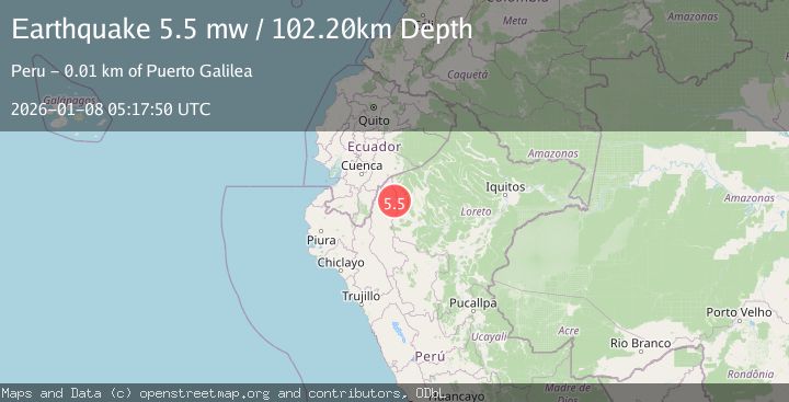
A 5.5 magnitude earthquake struck on PERU-ECUADOR BORDER REGION, at Thu, 08 Jan 2026 05:17:50 GMT. Depth: 102.2km. Reviewed by EMSC seismologists, this moderate quake occurred at a magnitude type of mw.
Magnitude
5.5
mw
Source
EMSC
Intensity
IV
Agency Reports
1 Sources| Source | Magnitude | Depth | Time |
|---|---|---|---|
| EMSCPrimary | 5.5 | 102 km | 3 months ago |
Earthquake Details
AutomaticEvent IDemsc_EMSC_20260108_0000076
QualityS
Tsunami PotentialNo
Magnitude Typemw
Last Update2 months ago
Nearest Places
Possibly felt by: 1.7M
- 14.8 km
- IIISaramiriza73.1 km
- IIIGualaquiza118.6 km4.6K people
- IIIYantzaza121.9 km10K people
- IIIZamora143.1 km15.3K people
- IIIBarranca146.9 km5.8K people
- 147.1 km471 people
- IIIChiriaco150.3 km
- IIISan Lorenzo152.2 km
- IILoja170.3 km274.1K people
- IIGualaceo170.9 km17.1K people
- IILa Unión174.6 km1.6K people
- IINulti174.9 km4.6K people
- IISucúa175.8 km7.4K people
- IILlacao181.4 km4.5K people
- IITaisha181.5 km
- IIAramango183.1 km
- IICatamayo187.5 km18.6K people
- IIAzogues188.4 km34.9K people
- IICuenca189.2 km637K people
- IIMacas189.9 km23.7K people
- IINamballe195.7 km
- 198.1 km7.9K people
- IINaranjos199.3 km
- 199.7 km661 people
- IILa Peca202.4 km27K people
- IIChirinos202.5 km
- 205.7 km
- 208.9 km
- IIBagua209.5 km
- IICañar209.9 km9.9K people
- 210.3 km3.6K people
- IILa Coipa210.8 km
- IIJeberos212.8 km
- 213.2 km16.9K people
- 214.2 km
- IICajaruro214.8 km7.3K people
- 217.4 km20.4K people
- IIZaruma217.6 km12.5K people
- 218.3 km9.7K people
- IICuispes219.7 km364 people
- 219.9 km10.9K people
- 220.1 km6.3K people
- IIJamalca222.2 km
- 223.6 km5.6K people
- 224.0 km
- IIMontalvo224.6 km
- 224.8 km
- 225.2 km295 people
- IIPiñas225.3 km17K people
- 227.3 km778 people
- IIHuabal229.9 km732 people
- 230.0 km6.4K people
- IIChuruja230.8 km248 people
- IIJaén231.8 km52.5K people
- IIOlleros232.5 km104 people
- 234.0 km443 people
- IIAlausí234.9 km14.3K people
- IIPosic235.3 km
- IIPaclas236.4 km365 people
- 236.4 km487 people
- 237.3 km143 people
- IIGranada238.1 km143 people
- IIAyabaca239.2 km5.3K people
- IIRioja239.9 km25.1K people
- IICalzada240.1 km
- IIOlto240.6 km498 people
- 243.4 km423 people
- 243.4 km50.1K people
- 243.4 km8.6K people
- IIChoros244.1 km367 people
- IILamud244.3 km
- IIHabana244.7 km
- IISondor245.0 km987 people
- IICumba245.6 km
- IIJilili246.0 km351 people
- IILuya247.2 km
- 247.3 km291 people
- IIHuancas247.3 km803 people
- IIPasaje247.5 km44.9K people
- 248.2 km311 people
- IIYorongos249.4 km
- 249.8 km
- IISoritor250.5 km10.9K people
- 250.8 km
- IIMontero250.9 km
- 251.8 km
- 252.0 km36.4K people
- IIDaguas252.4 km50 people
- 252.9 km7.2K people
- IIPalora253.1 km6.5K people
- 253.8 km32K people
- IICelica254.3 km5.5K people
- 254.5 km345 people
- IICheto255.6 km378 people
- 255.8 km410 people
- IISoloco256.3 km298 people
- IIMacará256.6 km13K people
- IILagunas258.3 km246 people
- IICujillo258.4 km
- IINaranjal259.3 km32K people
- 260.4 km41.8K people
- IILagunas262.2 km9.2K people
- IILevanto262.6 km485 people
- IISallique262.6 km894 people
- IIColcamar262.7 km
- IITunal262.8 km568 people
- IIPaimas263.1 km
- IIChalaco264.4 km
- IIBaláo265.1 km12.2K people
- IICollonce265.3 km628 people
- IIMaino265.5 km473 people
- IIMachala265.9 km289.1K people
- IISuyo265.9 km985 people
- 266.7 km871 people
- 267.7 km265 people
- IIYamango267.8 km973 people
- 269.6 km8.3K people
- IITingo269.7 km162 people
- 269.7 km694 people
- IILongar270.2 km957 people
- 271.3 km382 people
- IIMendoza271.7 km
- 271.8 km
- 272.2 km821 people
- IIHuarmaca272.2 km
- IICochamal272.4 km104 people
- 272.4 km
- IIColasay273.0 km975 people
- IIFrias274.8 km
- IILonguita275.1 km198 people
- IIHuambo275.1 km680 people
- 275.8 km41.8K people
- 276.0 km7.3K people
- IIRiobamba276.6 km264K people
- 276.9 km301 people
- IIPuyo277.6 km24.9K people
- 278.9 km
- IIOmia280.7 km604 people
- IILa Jalca281.6 km
- 281.9 km34.2K people
- IIGuano282.3 km12.7K people
- IIMatapalo282.4 km343 people
- IITotora282.6 km133 people
- IIMilpuc283.1 km386 people
- 284.2 km320 people
- IIPapayal284.7 km
- IISocota285.8 km
- 287.5 km14.7K people
- IIRoque288.1 km
- 289.3 km39.8K people
- 289.4 km
- IIMorropón289.4 km12.3K people
- 290.1 km
- 290.7 km9.1K people
- IICañaris291.7 km323 people
- 292.7 km7.9K people
- 293.0 km12.6K people
- 293.3 km7.3K people
- 293.3 km16.9K people
- 293.4 km249 people
- IIPaccha294.3 km
- IIMilagro294.7 km133.5K people
- 296.1 km9.4K people
- 296.3 km
- 296.3 km619 people
- IIBaños296.9 km9.5K people
- 296.9 km776 people
- 297.7 km403 people
- 298.0 km
- 298.8 km901 people
- 299.9 km237 people
- 300.6 km
- 300.7 km15.5K people
- 300.9 km13.7K people
- 301.8 km22.2K people
- 302.6 km5.8K people
- 303.8 km68.8K people
- 304.5 km
- 304.9 km
- 304.9 km
- 305.1 km
- 305.7 km27.9K people
- 306.0 km12.6K people
- 306.9 km417 people
- 306.9 km7K people
- 308.0 km16.6K people
- 308.0 km14.2K people
- 310.3 km
- 311.8 km96.9K people
- 312.1 km
- 312.2 km644 people
- 312.9 km
- 313.1 km
- 313.4 km315.7K people
- 313.7 km12.5K people
- 313.8 km
- ISisa314.1 km9.5K people
- 314.4 km766 people
- 314.4 km6.5K people
- 314.6 km2.7M people
- 315.2 km
- 315.6 km30K people
- 316.8 km76.3K people
- 317.5 km
- 317.8 km13.4K people
- 317.8 km24.9K people
- 318.3 km24.1K people
- 319.1 km387.3K people
- 319.5 km9.4K people
- 322.0 km9.8K people
- 322.0 km259 people
- 322.7 km201 people
- 324.1 km234 people
- 324.3 km
- 324.6 km7.5K people
- 324.6 km
- 324.9 km193 people
- 325.5 km12.5K people
- 325.5 km180 people
- 325.8 km
- 326.2 km
- 326.5 km968 people
- 327.1 km
- 327.3 km
- 327.6 km14.7K people
- ISexi327.6 km279 people
- 328.5 km4.7K people
- 329.4 km
- ITena330.0 km17.2K people
- 330.5 km
- 330.8 km351 people
- 331.1 km219 people
- 331.3 km9.7K people
- 331.6 km623 people
- IUtco331.7 km80 people
- 332.9 km13.7K people
- 333.9 km891 people
- 334.6 km713 people
- 335.1 km
- 335.1 km
- 335.3 km12.3K people
- 335.9 km30.6K people
- 336.1 km214 people
- 336.4 km8K people
- 337.5 km443 people
- 337.6 km717 people
- 339.0 km498 people
- 339.3 km979 people
- 339.4 km7.3K people
- 339.4 km3.7K people
- 339.7 km10.8K people
- 340.3 km32.3K people
- 340.6 km5.5K people
- 343.3 km38.2K people
- 343.9 km
- 344.2 km25.4K people
- 344.8 km449 people
- 345.5 km14.9K people
- 346.6 km173.7K people
- 346.7 km
- 348.6 km780 people
- 348.6 km5.4K people
- 348.6 km486 people
- 350.5 km
- 350.5 km160.8K people
- 351.8 km25.6K people
- 352.2 km205.6K people
- 352.6 km16.2K people
- 353.4 km32.5K people
- 353.7 km
- 353.7 km7.5K people
- 353.9 km
- 353.9 km16.1K people
- 354.6 km
- 355.4 km
- 355.5 km5.5K people
- 355.6 km
- 356.1 km484.5K people
- 358.3 km17.7K people
- 358.9 km732 people
- 359.5 km130K people
- 360.6 km6.1K people
- 360.6 km7.5K people
- 361.1 km
- 361.1 km6.7K people
- 361.4 km592 people
- 361.7 km
- 363.0 km
- 363.7 km9.1K people
- 364.0 km3.8K people
- ISojo364.3 km
- 364.4 km57.3K people
- 364.5 km15.2K people
- 364.6 km
- 365.0 km
- 365.1 km
- 366.3 km
- 367.2 km20.3K people
- 367.6 km638 people
- 367.9 km
- 368.1 km201.3K people
- 368.3 km6.3K people
- 369.0 km
- 369.3 km648 people
- 369.7 km
- 370.2 km922 people
- 371.3 km23.4K people
- 371.7 km405 people
- 372.3 km259 people
- 372.4 km
- 372.8 km37.7K people
- 372.8 km7K people
- 373.3 km
- 373.7 km9.4K people
- 374.1 km
- 374.2 km912 people
- 375.1 km9.1K people
- 376.3 km7.5K people
- 376.3 km
- 376.4 km264 people
- 376.5 km34.8K people
- 377.4 km16.4K people
- 377.6 km15.3K people
- 377.9 km4.3K people
- 378.5 km189 people
- 379.4 km34.4K people
- 379.4 km626 people
- 379.6 km
- 379.6 km5.9K people
- 379.8 km6.3K people
- 379.9 km8.5K people
- 380.3 km
- 380.6 km40.1K people
- 380.8 km
- 381.1 km179 people
- 381.3 km
- IVice381.3 km12.9K people
- 381.8 km908 people
- 381.9 km213.8K people
- 382.3 km
- 384.1 km
- 385.0 km
- 385.0 km43.6K people
- 386.3 km
- 386.5 km6.7K people
- 386.5 km6.8K people
- 386.9 km
- 389.9 km
- 390.2 km9.9K people
- 390.7 km7.4K people
- 391.0 km48.8K people
- ISaña391.4 km39.2K people
- 392.0 km23K people
- 392.4 km10.6K people
- 392.7 km
- 392.9 km43.7K people
- 393.2 km535 people
- 394.2 km355 people
- 394.5 km552.5K people
- 395.0 km9.3K people
- 395.1 km14.2K people
- 395.6 km48.1K people
- 396.2 km25.7K people
- 397.6 km
- 398.3 km10.1K people
- 400.2 km
- 401.4 km9.8K people
- 402.1 km56.2K people
- 402.5 km
- 402.7 km
- 403.0 km
- 403.1 km42.2K people
- 404.5 km222 people
- 404.5 km637 people
- 404.8 km
- 405.4 km99.1K people
- 405.5 km25.7K people
- 406.2 km233 people
- 406.6 km15.6K people
- 406.9 km9.2K people
- 407.8 km75.9K people
- IEten408.2 km13.7K people
- 409.0 km13.5K people
- 409.5 km
- 409.9 km546 people
- 410.3 km8.8K people
- 410.5 km
- 411.9 km42K people
- 412.0 km4.3K people
- 412.3 km5.1K people
- 412.8 km43.9K people
- 413.2 km5.8K people
- 414.1 km764 people
- 416.1 km600 people
- 417.5 km25.4K people
- 418.0 km447 people
- 419.0 km3.8K people
- 420.9 km652 people
- 423.1 km
- 424.9 km8K people
- 425.3 km2.8M people
- 425.7 km
- 426.6 km15.3K people
- 426.8 km
- 427.9 km734 people
- 428.6 km12.8K people
- 428.6 km
- 429.4 km21.8K people
- 432.6 km564 people
- 433.7 km
- 434.3 km35.9K people
- 434.9 km
- 436.1 km16.3K people
- 436.8 km29.2K people
- 436.9 km961 people
- 439.3 km9.1K people
- 439.5 km189 people
- 440.7 km
- 442.3 km
- 443.2 km
- 443.4 km17.3K people
- 444.7 km458.6K people
- 445.7 km
- 447.0 km14K people
- 447.2 km321.8K people
- 447.8 km26.6K people
- 449.3 km327 people
- 449.6 km9.2K people
- 449.8 km10.1K people
- 451.6 km44.8K people
- 452.1 km867 people
- 453.2 km
- 453.4 km14.7K people
- 453.8 km903 people
- 455.1 km
- 455.1 km75 people
- 456.0 km
- 456.9 km21.1K people
- 457.4 km10.3K people
- 457.5 km14.6K people
- 457.8 km24.2K people
- 457.9 km
- 458.2 km785 people
- 458.3 km580 people
- 459.5 km32.4K people
- 461.0 km
- 461.8 km709 people
- 462.0 km14.9K people
- 462.8 km708 people
- 463.9 km18.4K people
- 464.4 km805 people
- 466.3 km
- 466.8 km753 people
- 467.1 km4.4K people
- 468.4 km6.8K people
- 470.9 km32.3K people
- 471.6 km598 people
- 472.4 km
- 472.7 km179 people
- 474.1 km
- 474.6 km264.3K people
- 476.4 km13.9K people
- 477.5 km22K people
- 478.2 km8.2K people
- 478.8 km
- 479.5 km
- 479.8 km378 people
- 480.9 km
- 480.9 km17.5K people
- 481.1 km24.7K people
- 481.7 km
- 481.9 km221.1K people
- 482.0 km
- 482.5 km
- 482.6 km
- 483.0 km37.1K people
- 484.2 km242 people
- 484.5 km
- 484.6 km7.4K people
- 485.6 km7.3K people
- 485.6 km7.2K people
- 485.8 km
- 486.2 km919.9K people
- 487.0 km709 people
- 487.1 km29K people
- 487.2 km78.2K people
Felt Reports0
Did you feel this earthquake? Report it to help others.
No reports yet
Be the first to report this earthquake!
Latest Earthquakes
Loading...
Nearby Earthquakes
4.0Mag
NORTHERN PERU
Time1 month ago
Depth118.00 km
SourceLIM (Automatic)
4.2Mag
PERU-ECUADOR BORDER REGION
Time1 month ago
Depth10.00 km
SourceQUI (Automatic)
3.9Mag
PERU-ECUADOR BORDER REGION
Time3 months ago
Depth10.00 km
SourceNEIC (Automatic)
4.0Mag
NORTHERN PERU
Time6 months ago
Depth132.00 km
SourceLIM (Automatic)
4.0Mag
NORTHERN PERU
Time7 months ago
Depth112.00 km
SourceLIM (Automatic)