Earthquake NORTH ISLAND OF NEW ZEALAND
Thu, 29 Jan 2026 07:42:17 GMT
Time1 hour ago
Location
-40.8325, 175.4958
Depth
181.6 KM
Event Summary
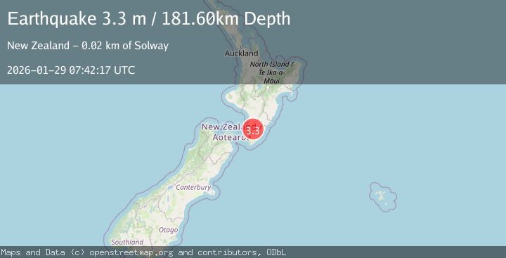
A 3.3 magnitude earthquake struck on NORTH ISLAND OF NEW ZEALAND, at Thu, 29 Jan 2026 07:42:17 GMT. Depth: 181.6km. Reviewed by GNS seismologists, this minor quake occurred at a magnitude type of m.
Magnitude
3.3
m
Source
GNS
Intensity
-
Agency Reports
1 Sources| Source | Magnitude | Depth | Time |
|---|---|---|---|
| GNSPrimary | 3.3 | 182 km | 1 hour ago |
Earthquake Details
AutomaticEvent IDemsc_GNS_20260129_0000106
Tsunami PotentialNo
Magnitude Typem
Nearest Places
- Blake0.8 km
- Mitre Flats1.4 km
- Stoney Creek1.4 km
- Lookout Point1.6 km
- Waingawa River Track2.1 km
Comments
Join the discussion about this event.
Latest Earthquakes
1.5Mag
14 km W of Johannesburg, CA
Time1 hour ago
Depth7.80 km
SourceUSGS (Automatic)
0.7Mag
4 km W of Cobb, CA
Time1 hour ago
Depth1.71 km
SourceUSGS (Automatic)
2.9Mag
Minahassa Peninsula, Sulawesi
Time2 hours ago
Depth10.00 km
SourceBMKG (Automatic)
2.5Mag
SAN JUAN, ARGENTINA
Time2 hours ago
Depth125.00 km
SourceNSNA (Automatic)
6.2Mag
SOUTH SANDWICH ISLANDS REGION
Time2 hours ago
Depth62.70 km
SourceEMSC (Automatic)
Nearby Earthquakes
3.7Mag
NORTH ISLAND OF NEW ZEALAND
Time3 days ago
Depth22.70 km
SourceGNS (Automatic)
3.0Mag
COOK STRAIT, NEW ZEALAND
Time1 week ago
Depth42.00 km
SourceGNS (Automatic)
4.4Mag
COOK STRAIT, NEW ZEALAND
Time2 days ago
Depth24.80 km
SourceGNS (Automatic)
3.0Mag
NORTH ISLAND OF NEW ZEALAND
Time5 days ago
Depth21.50 km
SourceGNS (Automatic)
3.5Mag
NORTH ISLAND OF NEW ZEALAND
Time4 days ago
Depth16.90 km
SourceGNS (Automatic)