Earthquake NORTH ISLAND OF NEW ZEALAND
Sat, 14 Feb 2026 10:01:17 GMT
Time5 days ago
Location
-39.3472, 175.0771
Depth
17.8 KM
Event Summary
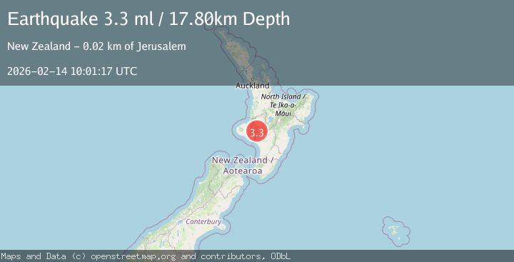
A 3.3 magnitude earthquake struck on NORTH ISLAND OF NEW ZEALAND, at Sat, 14 Feb 2026 10:01:17 GMT. Depth: 17.8km. Reviewed by GNS seismologists, this minor quake occurred at a magnitude type of ml.
Magnitude
3.3
ml
Source
GNS
Intensity
-
Agency Reports
1 Sources| Source | Magnitude | Depth | Time |
|---|---|---|---|
| GNSPrimary | 3.3 | 18 km | 5 days ago |
Earthquake Details
AutomaticEvent IDemsc_GNS_20260214_0000159
Tsunami PotentialNo
Magnitude Typeml
Nearest Places
- Maurikura Stream1.4 km
- Rakautangi1.7 km
- Rakautangi Stream2.2 km
- Hurikakano Stream2.8 km
- Ngapuke Whakatara2.8 km
Comments
Join the discussion about this event.
Latest Earthquakes
2.4Mag
West Papua Region, Indonesia
Time12 minutes ago
Depth10.00 km
SourceBMKG
3.3Mag
Talaud Islands, Indonesia
Time13 minutes ago
Depth10.00 km
SourceBMKG
1.1Mag
4 km NW of The Geysers, CA
Time13 minutes ago
Depth3.39 km
SourceUSGS (Automatic)
1.0Mag
33 km WSW of Ackerly, Texas
Time13 minutes ago
Depth4.44 km
SourceUSGS (Automatic)
2.8Mag
Antofagasta, Chile
Time17 minutes ago
Depth0.00 km
SourceVYT (Automatic)
Nearby Earthquakes
3.0Mag
NORTH ISLAND OF NEW ZEALAND
Time3 years ago
Depth17.00 km
SourceGNS (Automatic)
3.0Mag
NORTH ISLAND OF NEW ZEALAND
Time3 years ago
Depth128.00 km
SourceGNS (Automatic)
3.0Mag
NORTH ISLAND OF NEW ZEALAND
Time1 year ago
Depth107.90 km
SourceGNS (Automatic)
3.0Mag
NORTH ISLAND OF NEW ZEALAND
Time4 days ago
Depth16.80 km
SourceGNS (Automatic)
3.6Mag
NORTH ISLAND OF NEW ZEALAND
Time1 week ago
Depth17.70 km
SourceGNS (Automatic)