Earthquake STRAIT OF GIBRALTAR
Sat, 14 Feb 2026 06:55:17 GMT
Time5 days ago
Location
36.6321, -5.3112
Depth
0.0 KM
Event Summary
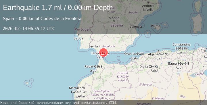
A 1.7 magnitude earthquake struck on STRAIT OF GIBRALTAR, at Sat, 14 Feb 2026 06:55:17 GMT. Depth: 0km. Reviewed by IGN seismologists, this minor quake occurred at a magnitude type of ml.
Magnitude
1.7
ml
Source
IGN
Intensity
-
Agency Reports
1 Sources| Source | Magnitude | Depth | Time |
|---|---|---|---|
| IGNPrimary | 1.7 | 0 km | 5 days ago |
Earthquake Details
AutomaticEvent IDemsc_IGN_20260214_0000115
Tsunami PotentialNo
Magnitude Typeml
Nearest Places
- Sierra Blanquilla2.6 km
- Cerro Bernal2.8 km
- Sol y Sierra3.0 km
- Cortes de la Frontera3.3 km
- Jimera de Líbar3.5 km
Comments
Join the discussion about this event.
Latest Earthquakes
1.3Mag
Southeastern Alaska
Time6 hours ago
Depth1.71 km
SourceVYT (Automatic)
2.9Mag
Central Alaska
Time6 hours ago
Depth0.00 km
SourceVYT (Automatic)
1.9Mag
Kenai Peninsula, Alaska
Time6 hours ago
Depth67.87 km
SourceVYT (Automatic)
1.2Mag
Southeastern Alaska
Time6 hours ago
Depth35.28 km
SourceVYT (Automatic)
3.3Mag
off the coast of Libertador O'Higgins, Chile
Time6 hours ago
Depth10.00 km
SourceVYT (Automatic)
Nearby Earthquakes
1.7Mag
STRAIT OF GIBRALTAR
Time6 days ago
Depth1.00 km
SourceIGN (Automatic)
1.8Mag
STRAIT OF GIBRALTAR
Time4 days ago
Depth0.00 km
SourceIGN (Automatic)
1.6Mag
STRAIT OF GIBRALTAR
Time1 week ago
Depth1.10 km
SourceIGN (Automatic)
2.0Mag
STRAIT OF GIBRALTAR
Time3 days ago
Depth0.00 km
SourceIGN (Automatic)
1.9Mag
STRAIT OF GIBRALTAR
Time5 days ago
Depth0.00 km
SourceIGN (Automatic)