Earthquake SOUTHERN ALASKA
Wed, 17 Jun 2020 03:16:58 GMT
Time5 years ago
Location
60.1700, -153.2900
Depth
137.0 KM
Event Summary
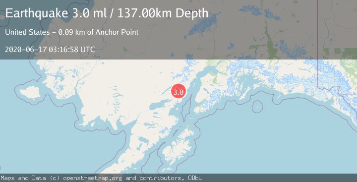
A 3.0 magnitude earthquake struck on SOUTHERN ALASKA, at Wed, 17 Jun 2020 03:16:58 GMT. Depth: 137km. Reviewed by NEIC seismologists, this minor quake occurred at a magnitude type of ml.
Magnitude
3.0
ml
Source
NEIC
Intensity
-
Agency Reports
1 Sources| Source | Magnitude | Depth | Time |
|---|---|---|---|
| NEICPrimary | 3.0 | 137 km | 5 years ago |
Earthquake Details
AutomaticEvent IDemsc_NEIC_20200617_0000027
Tsunami PotentialNo
Magnitude Typeml
Nearest Places
- Tuxedni Glacier11.5 km
- Tongue Glacier12.4 km
- Johnson Glacier15.8 km
- Chigmit Mountains16.2 km
- Mount Nick16.7 km
Comments
Join the discussion about this event.
Latest Earthquakes
2.4Mag
Finland
Time2 minutes ago
Depth301.88 km
SourceVYT (Automatic)
1.2Mag
Alaska Peninsula
Time3 minutes ago
Depth0.12 km
SourceVYT (Automatic)
4.1Mag
NEAR COAST OF NORTHERN PERU
Time8 minutes ago
Depth35.00 km
SourceLIM (Automatic)
3.1Mag
DODECANESE IS.-TURKEY BORDER REG
Time9 minutes ago
Depth4.10 km
SourceKOERI (Automatic)
2.6Mag
NEAR COAST OF NICARAGUA
Time14 minutes ago
Depth38.00 km
SourceINET (Automatic)
Nearby Earthquakes
2.5Mag
SOUTHERN ALASKA
Time1 month ago
Depth145.50 km
SourceNEIC (Automatic)
3.0Mag
SOUTHERN ALASKA
Time4 years ago
Depth141.00 km
SourceNEIC (Automatic)
3.0Mag
SOUTHERN ALASKA
Time12 years ago
Depth138.00 km
SourceNEIR (Automatic)
2.4Mag
SOUTHERN ALASKA
Time1 month ago
Depth146.90 km
SourceNEIC (Automatic)
1.9Mag
Southern Alaska
Time5 days ago
Depth136.84 km
SourceVYT (Automatic)