Earthquake SOUTHERN ALASKA
Mon, 19 Jan 2026 10:35:10 GMT
Time1 month ago
Location
60.1821, -153.3327
Depth
146.9 KM
Event Summary
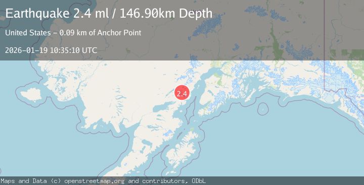
A 2.4 magnitude earthquake struck on SOUTHERN ALASKA, at Mon, 19 Jan 2026 10:35:10 GMT. Depth: 146.9km. Reviewed by NEIC seismologists, this minor quake occurred at a magnitude type of ml.
Magnitude
2.4
ml
Source
NEIC
Intensity
-
Agency Reports
1 Sources| Source | Magnitude | Depth | Time |
|---|---|---|---|
| NEICPrimary | 2.4 | 147 km | 1 month ago |
Earthquake Details
AutomaticEvent IDemsc_NEIC_20260119_0000356
Tsunami PotentialNo
Magnitude Typeml
Nearest Places
- Chigmit Mountains14.0 km
- Tuxedni Glacier14.2 km
- Tongue Glacier14.6 km
- Johnson Glacier18.5 km
- Tuxedni Glacier18.6 km
Comments
Join the discussion about this event.
Latest Earthquakes
1.7Mag
western Texas
Time6 minutes ago
Depth3.42 km
SourceVYT (Automatic)
3.8Mag
Seram, Indonesia
Time8 minutes ago
Depth0.00 km
SourceVYT (Automatic)
1.6Mag
54 km WNW of Toyah, Texas
Time13 minutes ago
Depth0.00 km
SourceUSGS (Automatic)
2.2Mag
West Papua Region, Indonesia
Time15 minutes ago
Depth26.69 km
SourceBMKG
1.2Mag
WESTERN TURKEY
Time15 minutes ago
Depth7.00 km
SourceAFAD (Automatic)
Nearby Earthquakes
2.5Mag
SOUTHERN ALASKA
Time1 month ago
Depth145.50 km
SourceNEIC (Automatic)
3.0Mag
SOUTHERN ALASKA
Time5 years ago
Depth137.00 km
SourceNEIC (Automatic)
3.0Mag
SOUTHERN ALASKA
Time4 years ago
Depth141.00 km
SourceNEIC (Automatic)
3.0Mag
SOUTHERN ALASKA
Time12 years ago
Depth138.00 km
SourceNEIR (Automatic)
1.9Mag
Southern Alaska
Time5 days ago
Depth136.84 km
SourceVYT (Automatic)