Earthquake HALMAHERA, INDONESIA
Thu, 15 Oct 2020 10:47:44 GMT
Time5 years ago
Location
2.4200, 128.1100
Depth
132.0 KM
Event Summary
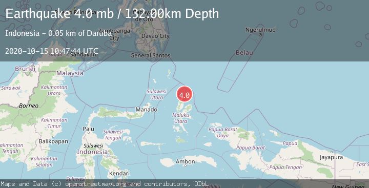
A 4.0 magnitude earthquake struck on HALMAHERA, INDONESIA, at Thu, 15 Oct 2020 10:47:44 GMT. Depth: 132km. Reviewed by NEIC seismologists, this light quake occurred at a magnitude type of mb.
Magnitude
4.0
mb
Source
NEIC
Intensity
-
Agency Reports
1 Sources| Source | Magnitude | Depth | Time |
|---|---|---|---|
| NEICPrimary | 4.0 | 132 km | 5 years ago |
Earthquake Details
AutomaticEvent IDemsc_NEIC_20201015_0000063
Tsunami PotentialNo
Magnitude Typemb
Nearest Places
- Tanjung Papaye6.3 km
- Pulau Tuanane6.3 km
- Desa Lou Madoro6.4 km
- Laumadoro6.9 km
- Tanjung Tutu8.1 km
Comments
Join the discussion about this event.
Latest Earthquakes
1.0Mag
Southeastern Alaska
Time7 minutes ago
Depth0.00 km
SourceVYT (Automatic)
3.5Mag
COOK STRAIT, NEW ZEALAND
Time8 minutes ago
Depth75.30 km
SourceGNS (Automatic)
2.5Mag
Seram, Indonesia
Time10 minutes ago
Depth21.28 km
SourceBMKG
2.6Mag
West Papua Region, Indonesia
Time12 minutes ago
Depth17.35 km
SourceBMKG
5.0Mag
CENTRAL MID-ATLANTIC RIDGE
Time13 minutes ago
Depth10.00 km
SourceEMSC (Automatic)
Nearby Earthquakes
3.2Mag
HALMAHERA, INDONESIA
Time1 month ago
Depth8.00 km
SourceBMKG (Automatic)
3.9Mag
Halmahera, Indonesia
Time3 days ago
Depth187.62 km
SourceVYT (Automatic)
4.0Mag
HALMAHERA, INDONESIA
Time6 years ago
Depth120.00 km
SourceDJA (Automatic)
3.0Mag
HALMAHERA, INDONESIA
Time2 years ago
Depth14.00 km
SourceDJA (Automatic)
3.4Mag
Halmahera, Indonesia
Time20 hours ago
Depth144.90 km
SourceVYT (Automatic)