Earthquake SOUTHERN YUKON TERRITORY, CANADA
Fri, 02 Jan 2026 18:13:25 GMT
Time1 month ago
Location
60.5120, -140.1164
Depth
5.1 KM
Event Summary
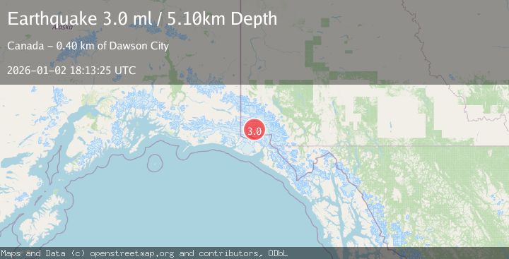
A 3.0 magnitude earthquake struck on SOUTHERN YUKON TERRITORY, CANADA, at Fri, 02 Jan 2026 18:13:25 GMT. Depth: 5.1km. Reviewed by NEIC seismologists, this minor quake occurred at a magnitude type of ml.
Magnitude
3.0
ml
Source
NEIC
Intensity
-
Agency Reports
1 Sources| Source | Magnitude | Depth | Time |
|---|---|---|---|
| NEICPrimary | 3.0 | 5 km | 1 month ago |
Earthquake Details
AutomaticEvent IDemsc_NEIC_20260102_0000316
Tsunami PotentialNo
Magnitude Typeml
Nearest Places
- Marker Lake7.1 km
- McArthur Peak11.8 km
- Mount Logan16.9 km
- Mount King George18.1 km
- Mount Queen Mary24.9 km
Comments
Join the discussion about this event.
Latest Earthquakes
1.2Mag
Central Alaska
Time19 minutes ago
Depth43.82 km
SourceVYT (Automatic)
1.6Mag
58 km S of Whites City, New Mexico
Time20 minutes ago
Depth4.17 km
SourceUSGS (Automatic)
1.3Mag
54 km WNW of Toyah, Texas
Time25 minutes ago
Depth0.00 km
SourceUSGS (Automatic)
3.1Mag
Oruro, Bolivia
Time29 minutes ago
Depth189.21 km
SourceVYT (Automatic)
3.4Mag
OFF COAST OF COSTA RICA
Time33 minutes ago
Depth10.00 km
SourceINET (Automatic)
Nearby Earthquakes
2.8Mag
SOUTHERN YUKON TERRITORY, CANADA
Time1 month ago
Depth5.00 km
SourceNEIC (Automatic)
3.0Mag
SOUTHERN YUKON TERRITORY, CANADA
Time1 month ago
Depth5.00 km
SourceNEIC (Automatic)
2.9Mag
SOUTHERN YUKON TERRITORY, CANADA
Time1 month ago
Depth5.00 km
SourceNEIC (Automatic)
3.5Mag
SOUTHERN YUKON TERRITORY, CANADA
Time1 month ago
Depth5.00 km
SourceNEIC (Automatic)
2.7Mag
SOUTHERN YUKON TERRITORY, CANADA
Time1 month ago
Depth5.00 km
SourceNEIC (Automatic)