Earthquake SOUTHERN YUKON TERRITORY, CANADA
Wed, 14 Jan 2026 11:12:46 GMT
Time1 month ago
Location
60.5026, -140.0962
Depth
5.0 KM
Event Summary
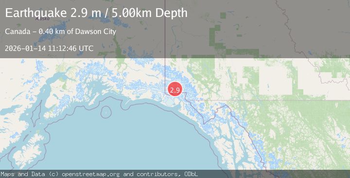
A 2.9 magnitude earthquake struck on SOUTHERN YUKON TERRITORY, CANADA, at Wed, 14 Jan 2026 11:12:46 GMT. Depth: 5km. Reviewed by NEIC seismologists, this minor quake occurred at a magnitude type of m.
Magnitude
2.9
m
Source
NEIC
Intensity
-
Agency Reports
1 Sources| Source | Magnitude | Depth | Time |
|---|---|---|---|
| NEICPrimary | 2.9 | 5 km | 1 month ago |
Earthquake Details
AutomaticEvent IDemsc_NEIC_20260114_0000265
Tsunami PotentialNo
Magnitude Typem
Nearest Places
- Marker Lake6.0 km
- McArthur Peak13.2 km
- Mount King George17.2 km
- Mount Logan18.4 km
- Mount Queen Mary24.6 km
Comments
Join the discussion about this event.
Latest Earthquakes
2.4Mag
Poland
Time15 hours ago
Depth0.24 km
SourceVYT (Automatic)
1.7Mag
Southern Alaska
Time15 hours ago
Depth13.79 km
SourceVYT (Automatic)
2.7Mag
Poland
Time15 hours ago
Depth0.00 km
SourceVYT (Automatic)
1.7Mag
54 km E of Pedro Bay, Alaska
Time15 hours ago
Depth111.30 km
SourceUSGS (Automatic)
2.0Mag
WESTERN TURKEY
Time15 hours ago
Depth11.00 km
SourceKOERI (Automatic)
Nearby Earthquakes
3.5Mag
SOUTHERN YUKON TERRITORY, CANADA
Time1 month ago
Depth5.00 km
SourceNEIC (Automatic)
5.3Mag
SOUTHERN YUKON TERRITORY, CANADA
Time1 month ago
Depth5.00 km
SourceNEIC (Automatic)
3.0Mag
SOUTHERN YUKON TERRITORY, CANADA
Time1 month ago
Depth5.10 km
SourceNEIC (Automatic)
2.7Mag
SOUTHERN YUKON TERRITORY, CANADA
Time1 month ago
Depth5.00 km
SourceNEIC (Automatic)
2.8Mag
SOUTHERN YUKON TERRITORY, CANADA
Time1 month ago
Depth5.00 km
SourceNEIC (Automatic)