Earthquake SOUTHERN ALASKA
Sun, 04 Jan 2026 06:25:01 GMT
Time1 month ago
Location
59.5782, -153.0003
Depth
110.8 KM
Event Summary
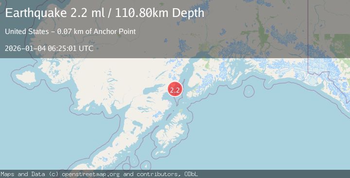
A 2.2 magnitude earthquake struck on SOUTHERN ALASKA, at Sun, 04 Jan 2026 06:25:01 GMT. Depth: 110.8km. Reviewed by NEIC seismologists, this minor quake occurred at a magnitude type of ml.
Magnitude
2.2
ml
Source
NEIC
Intensity
-
Agency Reports
1 Sources| Source | Magnitude | Depth | Time |
|---|---|---|---|
| NEICPrimary | 2.2 | 111 km | 1 month ago |
Earthquake Details
AutomaticEvent IDemsc_NEIC_20260104_0000112
Tsunami PotentialNo
Magnitude Typeml
Nearest Places
- Chinitna Point13.1 km
- Dry Bay13.3 km
- Brown Creek13.7 km
- Knub Hill13.9 km
- Bow Creek14.5 km
Comments
Join the discussion about this event.
Latest Earthquakes
1.2Mag
34 km WSW of Ackerly, Texas
Time23 hours ago
Depth3.87 km
SourceUSGS (Automatic)
1.2Mag
8 km SW of Morongo Valley, CA
Time23 hours ago
Depth15.22 km
SourceUSGS (Automatic)
2.4Mag
Northern Sumatra, Indonesia
Time23 hours ago
Depth7.72 km
SourceBMKG
2.3Mag
Tarapaca, Chile
Time23 hours ago
Depth61.65 km
SourceVYT (Automatic)
2.0Mag
Poland
Time23 hours ago
Depth2.32 km
SourceVYT (Automatic)
Nearby Earthquakes
2.0Mag
66 km ESE of Pedro Bay, Alaska
Time3 weeks ago
Depth95.00 km
SourceUSGS (Automatic)
1.7Mag
Southern Alaska
Time3 days ago
Depth99.00 km
SourceVYT (Automatic)
3.0Mag
SOUTHERN ALASKA
Time4 years ago
Depth98.00 km
SourceNEIC (Automatic)
1.9Mag
Southern Alaska
Time4 days ago
Depth60.18 km
SourceVYT (Automatic)
3.0Mag
SOUTHERN ALASKA
Time3 years ago
Depth105.00 km
SourceNEIC (Automatic)