Earthquake Southern Alaska
Sun, 15 Feb 2026 08:35:35 GMT
Time3 days ago
Location
59.5698, -152.9304
Depth
99.0 KM
Event Summary
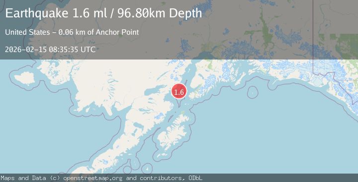
A 1.7 magnitude earthquake struck on Southern Alaska, at Sun, 15 Feb 2026 08:35:35 GMT. Depth: 98.9990234375km. Reviewed by VYT seismologists, this minor quake occurred at a magnitude type of earthquake.
Magnitude
1.7
earthquake
Source
VYT
Intensity
-
Agency Reports
2 Sources| Source | Magnitude | Depth | Time |
|---|---|---|---|
| VYTPrimary | 1.7 | 99 km | 3 days ago |
| USGS | 1.6 | 97 km | 3 days ago |
Earthquake Details
AutomaticEvent IDvyt_2iwjej6lunhln
Tsunami PotentialNo
Magnitude Typeearthquake
Nearest Places
- Chinitna Point15.3 km
- Bow Creek16.5 km
- Dry Bay16.5 km
- Brown Creek16.9 km
- Knub Hill17.5 km
Comments
Join the discussion about this event.
Latest Earthquakes
2.8Mag
Sunda Strait, Indonesia
Time6 minutes ago
Depth3.61 km
SourceBMKG
3.6Mag
south of Alaska
Time7 minutes ago
Depth10.00 km
SourceVYT (Automatic)
1.2Mag
Central Alaska
Time9 minutes ago
Depth68.97 km
SourceVYT (Automatic)
1.2Mag
Washington
Time11 minutes ago
Depth0.00 km
SourceVYT (Automatic)
0.8Mag
10 km WNW of The Geysers, CA
Time17 minutes ago
Depth1.96 km
SourceUSGS (Automatic)
Nearby Earthquakes
3.0Mag
SOUTHERN ALASKA
Time3 years ago
Depth105.00 km
SourceNEIC (Automatic)
2.2Mag
SOUTHERN ALASKA
Time1 month ago
Depth110.80 km
SourceNEIC (Automatic)
2.0Mag
66 km ESE of Pedro Bay, Alaska
Time3 weeks ago
Depth95.00 km
SourceUSGS (Automatic)
3.0Mag
SOUTHERN ALASKA
Time4 years ago
Depth98.00 km
SourceNEIC (Automatic)
3.0Mag
SOUTHERN ALASKA
Time4 years ago
Depth92.00 km
SourceNEIC (Automatic)