Earthquake MOLUCCA SEA
Sat, 10 Jan 2026 06:43:10 GMT
Time1 month ago
Location
0.7966, 125.1464
Depth
79.6 KM
Event Summary
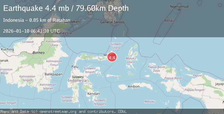
A 4.4 magnitude earthquake struck on MOLUCCA SEA, at Sat, 10 Jan 2026 06:43:10 GMT. Depth: 79.6km. Reviewed by NEIC seismologists, this light quake occurred at a magnitude type of mb.
Magnitude
4.4
mb
Source
NEIC
Intensity
-
Agency Reports
1 Sources| Source | Magnitude | Depth | Time |
|---|---|---|---|
| NEICPrimary | 4.4 | 80 km | 1 month ago |
Earthquake Details
AutomaticEvent IDemsc_NEIC_20260110_0000346
Tsunami PotentialNo
Magnitude Typemb
Nearest Places
- Pulau Pakolor29.6 km
- Pulau Balingbaling32.7 km
- Pulau Bentenan33.0 km
- Pulau Punten34.4 km
- Tanjung Popaya34.7 km
Comments
Join the discussion about this event.
Latest Earthquakes
0.6Mag
Southern Alaska
Time2 minutes ago
Depth0.00 km
SourceVYT (Automatic)
3.2Mag
Northern Molucca Sea
Time4 minutes ago
Depth78.57 km
SourceBMKG
1.3Mag
Oregon
Time4 minutes ago
Depth0.00 km
SourceVYT (Automatic)
2.0Mag
Tarapaca, Chile
Time7 minutes ago
Depth104.13 km
SourceVYT (Automatic)
2.0Mag
Tarapaca, Chile
Time9 minutes ago
Depth120.97 km
SourceVYT (Automatic)
Nearby Earthquakes
3.0Mag
MOLUCCA SEA
Time3 years ago
Depth19.00 km
SourceDJA (Automatic)
5.1Mag
MOLUCCA SEA
Time2 years ago
Depth70.00 km
SourceEMSC (Automatic)
4.0Mag
MOLUCCA SEA
Time4 years ago
Depth14.00 km
SourceDJA (Automatic)
3.8Mag
Northern Molucca Sea
Time1 week ago
Depth53.52 km
SourceBMKG
3.3Mag
MOLUCCA SEA
Time1 month ago
Depth13.00 km
SourceBMKG (Automatic)