Earthquake CENTRAL ALASKA
Fri, 16 Jan 2026 09:25:05 GMT
Time1 month ago
Location
62.9279, -151.2884
Depth
114.9 KM
Event Summary
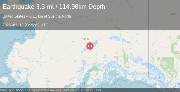
A 3.3 magnitude earthquake struck on CENTRAL ALASKA, at Fri, 16 Jan 2026 09:25:05 GMT. Depth: 114.9km. Reviewed by NEIC seismologists, this minor quake occurred at a magnitude type of ml.
Magnitude
3.3
ml
Source
NEIC
Intensity
-
Agency Reports
1 Sources| Source | Magnitude | Depth | Time |
|---|---|---|---|
| NEICPrimary | 3.3 | 115 km | 1 month ago |
Earthquake Details
AutomaticEvent IDemsc_NEIC_20260116_0000144
Tsunami PotentialNo
Magnitude Typeml
Nearest Places
- Mount Foraker6.7 km
- Mount Crosson9.0 km
- Southeast Fork Kahiltna Glacier9.6 km
- Mount Hunter10.4 km
- Kahiltna Glacier10.9 km
Comments
Join the discussion about this event.
Latest Earthquakes
1.2Mag
Czech Republic
Time46 seconds ago
Depth0.00 km
SourceVYT (Automatic)
2.1Mag
Tarapaca, Chile
Time7 minutes ago
Depth8.18 km
SourceVYT (Automatic)
1.4Mag
12 km ESE of Olancha, CA
Time7 minutes ago
Depth7.15 km
SourceUSGS (Automatic)
2.8Mag
northwestern Russia
Time8 minutes ago
Depth10.00 km
SourceVYT (Automatic)
3.3Mag
Near North Coast of West Papua
Time8 minutes ago
Depth10.00 km
SourceBMKG
Nearby Earthquakes
1.6Mag
53 km NNW of Petersville, Alaska
Time2 days ago
Depth109.00 km
SourceUSGS (Automatic)
1.9Mag
Central Alaska
Time16 hours ago
Depth100.95 km
SourceVYT (Automatic)
3.0Mag
CENTRAL ALASKA
Time5 years ago
Depth126.00 km
SourceNEIC (Automatic)
2.4Mag
CENTRAL ALASKA
Time3 weeks ago
Depth115.30 km
SourceNEIC (Automatic)
1.9Mag
Central Alaska
Time10 hours ago
Depth173.71 km
SourceVYT (Automatic)