Earthquake ALASKA PENINSULA
Mon, 19 Jan 2026 09:16:02 GMT
Time1 month ago
Location
54.5008, -160.1410
Depth
35.0 KM
Event Summary
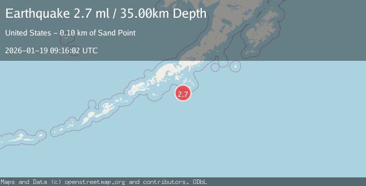
A 2.7 magnitude earthquake struck on ALASKA PENINSULA, at Mon, 19 Jan 2026 09:16:02 GMT. Depth: 35km. Reviewed by NEIC seismologists, this minor quake occurred at a magnitude type of ml.
Magnitude
2.7
ml
Source
NEIC
Intensity
-
Agency Reports
1 Sources| Source | Magnitude | Depth | Time |
|---|---|---|---|
| NEICPrimary | 2.7 | 35 km | 1 month ago |
Earthquake Details
AutomaticEvent IDemsc_NEIC_20260119_0000357
Tsunami PotentialNo
Magnitude Typeml
Nearest Places
- Point Welcome40.1 km
- Mountain Point40.9 km
- Bird Island43.3 km
- Point Farewell45.5 km
- Otter Strait47.1 km
Comments
Join the discussion about this event.
Latest Earthquakes
2.8Mag
Sunda Strait, Indonesia
Time6 minutes ago
Depth3.61 km
SourceBMKG
3.6Mag
south of Alaska
Time7 minutes ago
Depth10.00 km
SourceVYT (Automatic)
1.2Mag
Central Alaska
Time9 minutes ago
Depth68.97 km
SourceVYT (Automatic)
1.2Mag
Washington
Time11 minutes ago
Depth0.00 km
SourceVYT (Automatic)
0.8Mag
10 km WNW of The Geysers, CA
Time17 minutes ago
Depth1.96 km
SourceUSGS (Automatic)
Nearby Earthquakes
3.0Mag
ALASKA PENINSULA
Time7 months ago
Depth13.40 km
SourceAK (Automatic)
3.2Mag
Alaska Peninsula
Time2 days ago
Depth4.88 km
SourceVYT (Automatic)
3.0Mag
ALASKA PENINSULA
Time7 months ago
Depth20.10 km
SourceAK (Automatic)
3.0Mag
ALASKA PENINSULA
Time7 months ago
Depth21.70 km
SourceAK (Automatic)
5.1Mag
ALASKA PENINSULA
Time5 months ago
Depth5.70 km
SourceEMSC (Automatic)