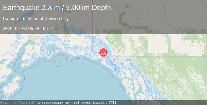
Earthquake SOUTHERN YUKON TERRITORY, CANADA
Mon, 02 Feb 2026 06:28:16 GMT
Time2 weeks ago
Location
60.2927, -139.3074
Depth
5.0 KM
Event Summary
A 2.8 magnitude earthquake struck on SOUTHERN YUKON TERRITORY, CANADA, at Mon, 02 Feb 2026 06:28:16 GMT. Depth: 5km. Reviewed by NEIC seismologists, this minor quake occurred at a magnitude type of m.
Magnitude
2.8
m
Source
NEIC
Intensity
-
Agency Reports
1 Sources| Source | Magnitude | Depth | Time |
|---|---|---|---|
| NEICPrimary | 2.8 | 5 km | 2 weeks ago |
Earthquake Details
AutomaticEvent IDemsc_NEIC_20260202_0000146
Tsunami PotentialNo
Magnitude Typem
Nearest Places
- Hubbard Glacier4.2 km
- Icefield Ranges6.0 km
- Hubbard Glacier6.9 km
- Alverstone Glacier9.1 km
- Alverstone Glacier11.3 km
Comments
Join the discussion about this event.
Latest Earthquakes
0.6Mag
Southern Alaska
Time2 minutes ago
Depth0.00 km
SourceVYT (Automatic)
2.3Mag
Antofagasta, Chile
Time3 minutes ago
Depth123.90 km
SourceVYT (Automatic)
2.7Mag
Tarapaca, Chile
Time6 minutes ago
Depth47.00 km
SourceVYT (Automatic)
1.3Mag
Southeastern Alaska
Time7 minutes ago
Depth0.00 km
SourceVYT (Automatic)
1.3Mag
53 km N of Petersville, Alaska
Time7 minutes ago
Depth126.60 km
SourceUSGS (Automatic)
Nearby Earthquakes
2.4Mag
SOUTHERN YUKON TERRITORY, CANADA
Time2 months ago
Depth5.00 km
SourceNEIC (Automatic)
2.8Mag
SOUTHERN YUKON TERRITORY, CANADA
Time1 month ago
Depth5.00 km
SourceNEIC (Automatic)
7.0Mag
SOUTHERN YUKON TERRITORY, CANADA
Time2 months ago
Depth10.80 km
SourceEMSC (Automatic)
5.2Mag
SOUTHERN YUKON TERRITORY, CANADA
Time21 years ago
Depth40.00 km
SourceEMSC (Automatic)
1.8Mag
92 km NNE of Yakutat, Alaska
Time3 days ago
Depth1.10 km
SourceUSGS (Automatic)