Earthquake 92 km NNE of Yakutat, Alaska
Mon, 16 Feb 2026 05:07:09 GMT
Time2 days ago
Location
60.3580, -139.3930
Depth
1.1 KM
Event Summary
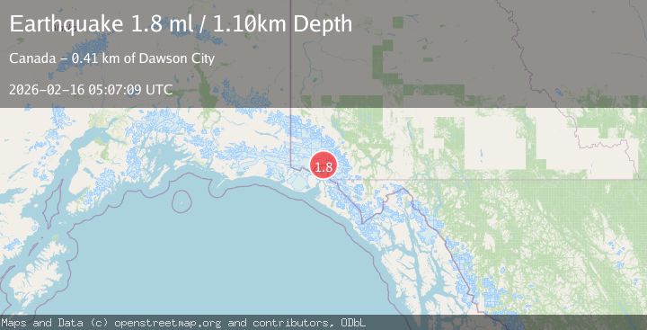
A 1.8 magnitude earthquake struck on 92 km NNE of Yakutat, Alaska, at Mon, 16 Feb 2026 05:07:09 GMT. Depth: 1.1km. Reviewed by USGS seismologists, this minor quake occurred at a magnitude type of ml.
Magnitude
1.8
ml
Source
USGS
Intensity
-
Agency Reports
1 Sources| Source | Magnitude | Depth | Time |
|---|---|---|---|
| USGSPrimary | 1.8 | 1 km | 2 days ago |
Earthquake Details
AutomaticEvent IDusgs_ak2026dgvpdz
Tsunami PotentialNo
Magnitude Typeml
Nearest Places
- Hubbard Glacier1.8 km
- Hubbard Glacier5.0 km
- Icefield Ranges12.4 km
- Alverstone Glacier14.1 km
- Alverstone Glacier15.3 km
Comments
Join the discussion about this event.
Latest Earthquakes
3.6Mag
Fox Islands, Aleutian Islands, Alaska
Time6 hours ago
Depth28.81 km
SourceVYT (Automatic)
1.3Mag
Washington
Time6 hours ago
Depth0.00 km
SourceVYT (Automatic)
2.0Mag
Antofagasta, Chile
Time6 hours ago
Depth28.32 km
SourceVYT (Automatic)
1.2Mag
Central Alaska
Time6 hours ago
Depth0.00 km
SourceVYT (Automatic)
2.1Mag
Sulawesi, Indonesia
Time6 hours ago
Depth7.10 km
SourceBMKG
Nearby Earthquakes
3.0Mag
SOUTHERN YUKON TERRITORY, CANADA
Time2 months ago
Depth1.60 km
SourceAK (Automatic)
2.8Mag
SOUTHERN YUKON TERRITORY, CANADA
Time3 weeks ago
Depth5.90 km
SourceNEIC (Automatic)
3.0Mag
SOUTHERN YUKON TERRITORY, CANADA
Time2 months ago
Depth5.00 km
SourceNEIC (Automatic)
3.0Mag
SOUTHERN YUKON TERRITORY, CANADA
Time2 months ago
Depth5.00 km
SourceNEIC (Automatic)
3.8Mag
SOUTHERN YUKON TERRITORY, CANADA
Time2 weeks ago
Depth2.00 km
SourceAK (Automatic)