Earthquake SOUTHERN ALASKA
Mon, 13 Jan 2014 12:38:27 GMT
Time12 years ago
Location
59.7000, -153.4500
Depth
125.0 KM
Event Summary
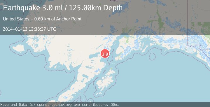
A 3.0 magnitude earthquake struck on SOUTHERN ALASKA, at Mon, 13 Jan 2014 12:38:27 GMT. Depth: 125km. Reviewed by NEIR seismologists, this minor quake occurred at a magnitude type of ml.
Magnitude
3.0
ml
Source
NEIR
Intensity
-
Agency Reports
1 Sources| Source | Magnitude | Depth | Time |
|---|---|---|---|
| NEIRPrimary | 3.0 | 125 km | 12 years ago |
Earthquake Details
AutomaticEvent IDemsc_NEIR_20140113_0000054
Tsunami PotentialNo
Magnitude Typeml
Nearest Places
- Iniskin Bay1.8 km
- Back Range4.2 km
- Keystone Creek5.0 km
- Pomeroy Creek5.1 km
- Right Arm Iniskin Bay5.2 km
Comments
Join the discussion about this event.
Latest Earthquakes
2.9Mag
northern Sumatra, Indonesia
Time1 minute ago
Depth4.52 km
SourceVYT (Automatic)
1.6Mag
Kenai Peninsula, Alaska
Time8 minutes ago
Depth42.60 km
SourceVYT (Automatic)
2.4Mag
Finland
Time11 minutes ago
Depth301.88 km
SourceVYT (Automatic)
1.2Mag
Alaska Peninsula
Time11 minutes ago
Depth0.12 km
SourceVYT (Automatic)
2.6Mag
SAN JUAN, ARGENTINA
Time12 minutes ago
Depth92.00 km
SourceNSNA (Automatic)
Nearby Earthquakes
7.1Mag
SOUTHERN ALASKA
Time10 years ago
Depth128.00 km
SourceNEIC (Automatic)
3.0Mag
SOUTHERN ALASKA
Time8 years ago
Depth106.00 km
SourceNEIR (Automatic)
3.0Mag
SOUTHERN ALASKA
Time7 years ago
Depth129.00 km
SourceNEIR (Automatic)
3.0Mag
SOUTHERN ALASKA
Time5 years ago
Depth118.00 km
SourceNEIC (Automatic)
3.0Mag
SOUTHERN ALASKA
Time4 years ago
Depth129.00 km
SourceNEIC (Automatic)