Earthquake KENAI PENINSULA, ALASKA
Sun, 16 Feb 2014 13:16:18 GMT
Time12 years ago
Location
60.5000, -151.4800
Depth
85.0 KM
Event Summary
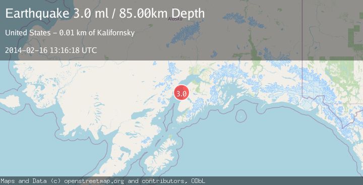
A 3.0 magnitude earthquake struck on KENAI PENINSULA, ALASKA, at Sun, 16 Feb 2014 13:16:18 GMT. Depth: 85km. Reviewed by NEIR seismologists, this minor quake occurred at a magnitude type of ml.
Magnitude
3.0
ml
Source
NEIR
Intensity
-
Agency Reports
1 Sources| Source | Magnitude | Depth | Time |
|---|---|---|---|
| NEIRPrimary | 3.0 | 85 km | 12 years ago |
Earthquake Details
AutomaticEvent IDemsc_NEIR_20140216_0000045
Tsunami PotentialNo
Magnitude Typeml
Nearest Places
- Salmo Rock7.4 km
- Karluk Reef7.5 km
- Central Emergency Services Station 4 K Beach Station11.3 km
- KPEN-FM (Soldotna)11.6 km
- Kalifornsky Beach11.6 km
Comments
Join the discussion about this event.
Latest Earthquakes
3.4Mag
Flores region, Indonesia
Time9 hours ago
Depth22.83 km
SourceVYT (Automatic)
2.4Mag
Sumbawa Region, Indonesia
Time9 hours ago
Depth10.00 km
SourceBMKG
1.3Mag
3 km SSW of Cobb, CA
Time9 hours ago
Depth0.36 km
SourceUSGS (Automatic)
1.8Mag
Southern California
Time9 hours ago
Depth13.43 km
SourceVYT (Automatic)
1.9Mag
Southern Alaska
Time9 hours ago
Depth0.00 km
SourceVYT (Automatic)
Nearby Earthquakes
2.4Mag
13 km W of Kenai, Alaska
Time1 week ago
Depth69.00 km
SourceUSGS (Automatic)
1.7Mag
Kenai Peninsula, Alaska
Time1 day ago
Depth51.76 km
SourceVYT (Automatic)
3.0Mag
KENAI PENINSULA, ALASKA
Time1 year ago
Depth71.80 km
SourceNEIC (Automatic)
2.3Mag
Kenai Peninsula, Alaska
Time1 week ago
Depth14.16 km
SourceVYT (Automatic)
3.0Mag
KENAI PENINSULA, ALASKA
Time7 years ago
Depth59.00 km
SourceNEIR (Automatic)