Earthquake HAWAII REGION, HAWAII
Fri, 20 Jan 2017 16:15:49 GMT
Time9 years ago
Location
19.3600, -156.3500
Depth
31.0 KM
Event Summary
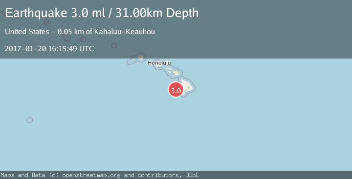
A 3.0 magnitude earthquake struck on HAWAII REGION, HAWAII, at Fri, 20 Jan 2017 16:15:49 GMT. Depth: 31km. Reviewed by NEIR seismologists, this minor quake occurred at a magnitude type of ml.
Magnitude
3.0
ml
Source
NEIR
Intensity
-
Agency Reports
1 Sources| Source | Magnitude | Depth | Time |
|---|---|---|---|
| NEIRPrimary | 3.0 | 31 km | 9 years ago |
Earthquake Details
AutomaticEvent IDemsc_NEIR_20170120_0000091
Tsunami PotentialNo
Magnitude Typeml
Nearest Places
- `Ālika Knoll17.1 km
- Keawekāheka Point44.3 km
- Nenue Point44.4 km
- Keikiwaha Point44.6 km
- Keawekāheka Bay44.7 km
Comments
Join the discussion about this event.
Latest Earthquakes
2.2Mag
Northern Sumatra, Indonesia
Time2 hours ago
Depth8.25 km
SourceBMKG
2.5Mag
CRETE, GREECE
Time2 hours ago
Depth17.50 km
SourceNOA (Automatic)
2.5Mag
Tarapaca, Chile
Time2 hours ago
Depth112.55 km
SourceVYT (Automatic)
2.0Mag
ALBANIA
Time2 hours ago
Depth15.00 km
SourceIGEO (Automatic)
2.3Mag
CENTRAL TURKEY
Time2 hours ago
Depth6.20 km
SourceAFAD (Automatic)
Nearby Earthquakes
3.0Mag
HAWAII REGION, HAWAII
Time2 years ago
Depth39.80 km
SourceNEIC (Automatic)
3.0Mag
HAWAII REGION, HAWAII
Time10 years ago
Depth42.00 km
SourceNEIC (Automatic)
1.7Mag
51 km WSW of Kailua-Kona, Hawaii
Time2 days ago
Depth0.32 km
SourceUSGS (Automatic)
3.0Mag
HAWAII REGION, HAWAII
Time1 year ago
Depth117.40 km
SourceHV (Automatic)
3.0Mag
HAWAII REGION, HAWAII
Time11 months ago
Depth34.90 km
SourceHV (Automatic)