Earthquake 51 km WSW of Kailua-Kona, Hawaii
Mon, 16 Feb 2026 19:20:47 GMT
Time2 days ago
Location
19.4255, -156.4338
Depth
0.3 KM
Event Summary
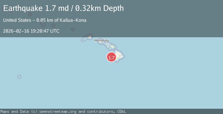
A 1.7 magnitude earthquake struck on 51 km WSW of Kailua-Kona, Hawaii, at Mon, 16 Feb 2026 19:20:47 GMT. Depth: 0.319999992847443km. Reviewed by USGS seismologists, this minor quake occurred at a magnitude type of md.
Magnitude
1.7
md
Source
USGS
Intensity
-
Agency Reports
1 Sources| Source | Magnitude | Depth | Time |
|---|---|---|---|
| USGSPrimary | 1.7 | 0 km | 2 days ago |
Earthquake Details
AutomaticEvent IDusgs_hv74900647
Tsunami PotentialNo
Magnitude Typemd
Nearest Places
- `Ālika Knoll8.5 km
- Indianapolis Seamount36.2 km
- Kaiwi Point49.3 km
- Keahuolu Point49.4 km
- Pawai Bay49.6 km
Comments
Join the discussion about this event.
Latest Earthquakes
1.7Mag
54 km E of Pedro Bay, Alaska
Time22 hours ago
Depth111.30 km
SourceUSGS (Automatic)
1.8Mag
Western Australia
Time22 hours ago
Depth0.00 km
SourceVYT (Automatic)
2.8Mag
Southern Sumatra, Indonesia
Time22 hours ago
Depth6.29 km
SourceBMKG
3.2Mag
OFF W. COAST OF S. ISLAND, N.Z.
Time22 hours ago
Depth10.00 km
SourceGNS (Automatic)
1.9Mag
Tarapaca, Chile
Time22 hours ago
Depth109.74 km
SourceVYT (Automatic)
Nearby Earthquakes
3.0Mag
HAWAII REGION, HAWAII
Time2 years ago
Depth39.80 km
SourceNEIC (Automatic)
3.0Mag
HAWAII REGION, HAWAII
Time9 years ago
Depth31.00 km
SourceNEIR (Automatic)
3.0Mag
HAWAII REGION, HAWAII
Time10 years ago
Depth42.00 km
SourceNEIC (Automatic)
3.0Mag
HAWAII REGION, HAWAII
Time6 years ago
Depth34.00 km
SourceNEIR (Automatic)
3.0Mag
HAWAII REGION, HAWAII
Time1 year ago
Depth117.40 km
SourceHV (Automatic)