Earthquake SOUTHERN ALASKA
Wed, 22 Nov 2017 08:27:35 GMT
Time8 years ago
Location
59.4000, -152.4900
Depth
64.0 KM
Event Summary
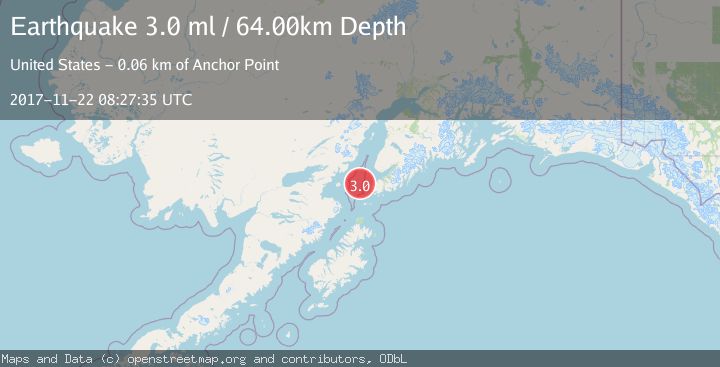
A 3.0 magnitude earthquake struck on SOUTHERN ALASKA, at Wed, 22 Nov 2017 08:27:35 GMT. Depth: 64km. Reviewed by NEIR seismologists, this minor quake occurred at a magnitude type of ml.
Magnitude
3.0
ml
Source
NEIR
Intensity
-
Agency Reports
1 Sources| Source | Magnitude | Depth | Time |
|---|---|---|---|
| NEIRPrimary | 3.0 | 64 km | 8 years ago |
Earthquake Details
AutomaticEvent IDemsc_NEIR_20171122_0000032
Tsunami PotentialNo
Magnitude Typeml
Nearest Places
- Jakolof Bay7.8 km
- Flat Island Light29.1 km
- Flat Islands29.2 km
- Magnet Rock29.3 km
- Point Bede29.9 km
Comments
Join the discussion about this event.
Latest Earthquakes
2.3Mag
Tarapaca, Chile
Time1 minute ago
Depth114.14 km
SourceVYT (Automatic)
2.1Mag
Southern Alaska
Time5 minutes ago
Depth67.26 km
SourceVYT (Automatic)
2.2Mag
western Russia
Time8 minutes ago
Depth0.00 km
SourceVYT (Automatic)
1.5Mag
4 km NNW of The Geysers, CA
Time9 minutes ago
Depth-0.27 km
SourceUSGS (Automatic)
1.0Mag
9 km WNW of Two Rivers, Alaska
Time9 minutes ago
Depth5.70 km
SourceUSGS (Automatic)
Nearby Earthquakes
3.0Mag
SOUTHERN ALASKA
Time7 years ago
Depth66.00 km
SourceNEIR (Automatic)
1.6Mag
Southern Alaska
Time2 hours ago
Depth75.56 km
SourceVYT (Automatic)
2.3Mag
Southern Alaska
Time1 day ago
Depth205.20 km
SourceVYT (Automatic)
3.0Mag
SOUTHERN ALASKA
Time1 month ago
Depth76.70 km
SourceNEIC (Automatic)
2.1Mag
47 km W of Nanwalek, Alaska
Time1 week ago
Depth85.40 km
SourceUSGS (Automatic)